
- Incorporated 1868 - summer (DST) Eastern (UTC-4) Local time Sunday 3:52 AM | - Unincorporated January 1998 (1998-01) Zip code 16415 Area code 814 | |
 | ||
Weather -4°C, Wind NW at 16 km/h, 54% Humidity Area 9.169 km² (9.117 km² Land / 8 ha Water) | ||
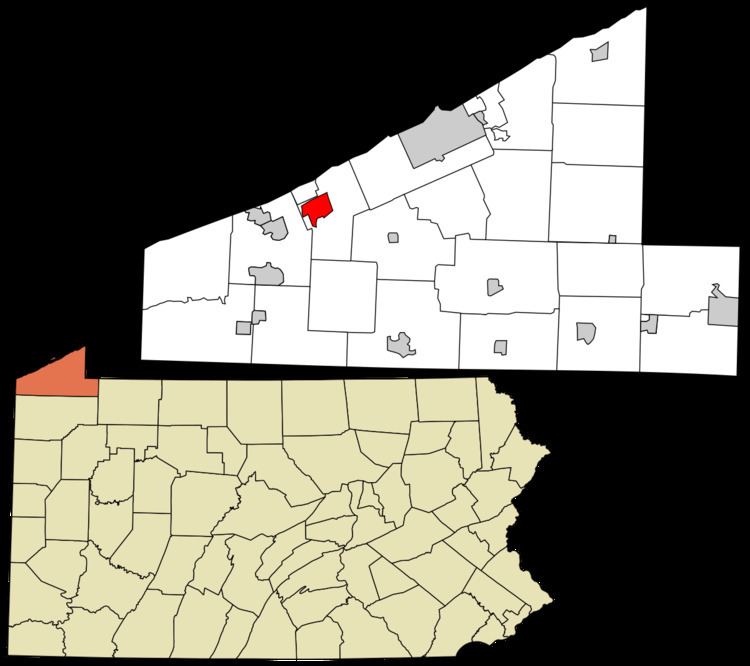
Fairview is an unincorporated community and census-designated place (CDP) in central Fairview Township, Erie County, Pennsylvania, United States. It is served by the 16415 ZIP code and the Fairview School District. It was incorporated as a separate borough in 1868 with an area of about a square mile and a population of roughly 400. After a referendum in 1994, it was decided to dissolve the borough; dissolution was completed in January 1998. As of the 2010 census the population was 2,348, out of a total 10,102 residents in Fairview Township.
Contents
Map of Fairview, PA, USA
Geography
Fairview is located west of the center of Erie County, in the west-central part of Fairview Township. It is bordered to the north by the unincorporated community of Avonia. U.S. Route 20 (West Ridge Road) passes through the center of Fairview, leading northeast 11 miles (18 km) into Erie and southwest 4 miles (6 km) to Girard. Pennsylvania Route 98 (Avonia Road) crosses US 20 in the center of Fairview, leading north 1.2 miles (1.9 km) to Avonia and south 2 miles (3 km) to Interstate 90 Exit 16.
According to the U.S. Census Bureau, the Fairview CDP has an area of 3.54 square miles (9.18 km2), of which 0.03 square miles (0.07 km2), or 0.75%, is water.