
Time zone UTC (UTC-6) | Neighbourhood Fairhaven Population 4,990 (2005) | |
 | ||
Fairhaven is a neighbourhood in Saskatoon, Saskatchewan, Canada. It is close to both Catholic and public elementary schools. A strip mall is within the Fairhaven subdivision. The Confederation Suburban Centre is to the north. According to MLS data, the average sale price of a home as of 2013 was $248,908.
Contents
Map of Fairhaven, Saskatoon, SK, Canada
History
Fairhaven first appeared on a 1913 map compiled by City Commissioner Christopher J. Yorath that plotted out a number of proposed communities along the periphery of Saskatoon, many of which were never developed. The community of Fairhaven first officially appeared on city maps circa 1971, in the same location as on the Yorath map, and the layout of streets in the community underwent several revisions before development began in earnest in the mid-1970s, with most construction in the area complete by 1985, however there remained undeveloped lots on the east side of the community that in the early 2010s were filled with the relocation of six-plex homes from the former McNab Park neighbourhood.
Sarah Shatwell Pendygrasse arrived from England in 1887 and was awarded a dominion land grant patent at SE section 20 township 36 range 5 W of the 3rd meridian, Saskatchewan provisional district, North West Territories on December 12, 1892. Her son Harold L. S. Pendygrasse homestead at NE Section 20 township 35 Range 3 W of the 3rd meridian. At 1919 St. Henry Avenue, Exhibition subdivision the Pendygrasse Home built by Harold Pendygrasse in 1910 has been declared a municipal heritage site. It is built on the banks of the South Saskatchewan river east side of Saskatoon.
When Fairhaven first appeared on the maps, the street names all had one thing in common: they all started with the letter F. When the community was re-plotted in the mid-1970s, this was abandoned (except for Fairlight Drive and Fairmont Drive) and most other streets in the area were named for prominent city officials of the past, such as former city councillors S.E. Bushe, E.H. Crimp, G.A. Forrester, J.J. Olmstead, and James Priel.
When the community of Parkridge was first planned to the west of Fairhaven, it was identified on maps as "Fairhaven II" or "Fairhaven West" until a unique name was given to the area.
Education
Area parks
City transit
Fairhaven is serviced by the City Transit Bus Routes 5 (McCormack/City Centre)services the neighbourhood boundary on Fairlight Drive & Route 9 (Riversdale/City Centre) of Saskatoon Transit.
Layout
Fairmont Drive provides the eastern boundary of Fairhaven (residences and businesses to the east of Fairmont are actually within the adjacent Confederation Suburban Centre. Fairlight Drive arcs above to the north as well as the western edge. Lochrie Crescent and Barber Place, Terrace, and Court are connected to Pendygrasse road and are included within the southern perimeter of Fairhaven. The Canadian Pacific Railway delimits the southern edge. Prior to the construction of the Circle Drive and 22nd Street interchange, motorists were able to access the Meadowgreen neighbourhood via Clancy Drive through a signalized grade crossing intersection at 18th Street and Circle Drive. When the initial plan called for the interchange having no access to eastbound 22nd Street from southbound Circle Drive, a re-drawing saw the western leg of Camponi Crescent and northbound Fairmont Drive become part of the interchange with access to 18th Street via Clancy Drive ceasing to exist, the signalized grade crossing intersection at Circle Drive and Clancy Drive remains as it was reconfigured to a layout similar to that of the intersection of Circle Drive & Laurier Drive following the closure of 18th Street; southbound traffic on Circle encounters a traffic signal, but northbound traffic is freeflow. However, if an overpass is proposed at Circle & Clancy, 18th Street could possibly be reconnected.
Life
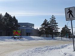
Fairhaven Community Association provides recreational activities at both St. Mark and Fairhaven school, as well as using the common green space between them provided by Herbert S. Sears Park.