
Country United States County Berrien FIPS code 26-27160 Population 7,631 (2010) | Time zone Eastern (EST) (UTC-5) Elevation 214 m Area code 269 | |
 | ||
Area 11.4 km² (10.88 km² Land / 52 ha Water) | ||
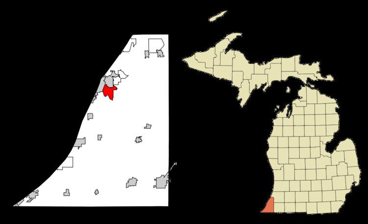
Fair Plain (also "Fairplain") is an unincorporated community in Berrien County in the U.S. state of Michigan. It is a census-designated place (CDP) for statistical purposes and has no legal status as a municipality. The population of the CDP was 7,631 at the 2010 census.
Contents
Map of Fair Plain, MI 49022, USA
The Fair Plain CDP consists of the portion of St. Joseph Charter Township lying northeast of the St. Joseph River and a portion of Benton Charter Township. The CDP's boundaries are the city of Benton Harbor to the north, the St. Joseph River to the west and south, and M-139 to the east.
Fair Plain was largely an agricultural area with fruit orchards in the 19th and early 20th centuries until it evolved into a residential area. The post-World War II years saw the construction of many homes in Fair Plain and the movement of many families from the nearby city of Benton Harbor to Fair Plain. To this day, many large old farm houses and barns can be found in Fair Plain, primarily on or near Fairplain Avenue and Jakway Avenue. Miami Drive is one of the most prestigious streets in Fair Plain with many large stately homes on large lots overlooking the St. Joseph River.
Until the mid-1960s, Fair Plain had its own school district with a junior high school (7th through 9th grades) and four elementary schools - Fair Plain West, Fair Plain East, Fair Plain Northwest and Fair Plain Northeast. The boundaries between the four elementary schools were the cross-roads of Colfax Avenue and Napier Avenue. Before it was expanded and the four elementary schools built, the junior high school building was known as Fair Plain Central. The mascot of the junior high school was the Colt, and the school song was "Onward Fair Plain", played to the tune of "On, Wisconsin". In the mid-1960s, the Fair Plain School District, together with others, was consolidated into the school district of the city of Benton Harbor.
A notable stately home in Fair Plain is the Elisha Gray Home on Nickerson Avenue. The WHFB/WQLQ radio station is located on Fairplain Avenue, and the Berrien Hills Golf Club is on the banks of the St. Joseph River.
The Fairplain Plaza, located on M-139 just outside Fair Plain, was the first shopping center in the area. The original Fairplain Plaza was largely torn down by the late 1990s, but was subsequently rebuilt and expanded in a different format.
Geography
According to the United States Census Bureau, the CDP has a total area of 4.4 square miles (11.5 km2), of which 4.2 square miles (10.9 km2) is land and 0.23 square miles (0.6 km2), or 5.22%, is water.
Demographics
As of the census of 2000, there were 7,828 people, 3,287 households, and 2,116 families residing in the CDP. The population density was 1,860.2 per square mile (717.9/km²). There were 3,436 housing units at an average density of 816.5 per square mile (315.1/km²). The racial makeup of the CDP was 49.08% White, 47.42% Black or African American, 0.46% Native American, 0.66% Asian, 0.06% Pacific Islander, 0.88% from other races, and 1.43% from two or more races. Hispanic or Latino of any race were 1.67% of the population.
There were 3,287 households out of which 27.1% had children under the age of 18 living with them, 43.2% were married couples living together, 17.3% had a female householder with no husband present, and 35.6% were non-families. 29.7% of all households were made up of individuals and 10.0% had someone living alone who was 65 years of age or older. The average household size was 2.37 and the average family size was 2.91.
In the CDP, the population was spread out with 24.5% under the age of 18, 7.7% from 18 to 24, 29.5% from 25 to 44, 24.3% from 45 to 64, and 14.0% who were 65 years of age or older. The median age was 38 years. For every 100 females there were 91.9 males. For every 100 females age 18 and over, there were 86.7 males.
The median income for a household in the CDP was $37,154, and the median income for a family was $45,950. Males had a median income of $34,524 versus $24,043 for females. The per capita income for the CDP was $20,344. About 10.8% of families and 16.0% of the population were below the poverty line, including 30.5% of those under age 18 and 5.6% of those age 65 or over.