
Metropolitan borough Sheffield Sovereign state United Kingdom Postcode district S36 Dialling code 0114 | Country England Post town SHEFFIELD Metropolitan county South Yorkshire | |
 | ||
Region Yorkshire and the Humber | ||
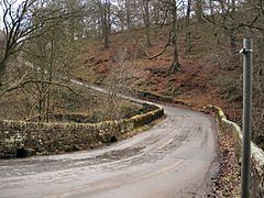
Ewden Valley is a valley in the civil parish of Bradfield in the Stocksbridge and Upper Don electoral ward of Sheffield, South Yorkshire, England.
Map of Ewden Village, Deepcar, Sheffield, UK
Ewden Village is located between the Moor Hall and Broomhead reservoirs, close to and south of Bolsterone,; within the Civil Parish of Stocksbridge. During the early 20th century a timber built village was constructed, to house workers working on the Morehall and Broomhead reservoirs. The village was completed in 1929. By 1969 only 15 of over 70 buildings were occupied, and by the 21st century the village was practically abandoned. By 2008 a single worker's cottage remained from the original navvy village.
Ewden Beck flows from Broomhead Moor, eastwards, supplying the Broomhead reservoir. Excess outfall flows into the River Don. Ewden Height is a local high point in the region at 375 m (1,230 ft).
One the south side of the beck, upstream of the reservoirs and Ewden road bridge are prehistoric earthworks and other remains: there is a Bronze Age cemetery of around 30 round barrows, typically less than 3m diameter and 0.2 to 1 m (7.9 in to 3 ft 3.4 in) high, which are crossed by an earthwork 'Broomhead Dyke', around 1,200 m (3,900 ft) long, running roughly parallel to the beck; there is also a 20 m (66 ft) diameter ring cairn around 100m north of the cemetery.