
Country United States Named for James Evart Zip code 49631 Local time Thursday 10:56 PM | Founded 1871 Elevation 307 m Population 1,890 (2013) | |
 | ||
Founded by D. A. Blodgett and James Kennedy Weather -3°C, Wind W at 5 km/h, 49% Humidity | ||
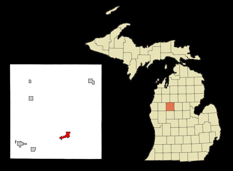
Evart is a city in Osceola County in the U.S. state of Michigan. The population was 1,903 at the 2010 census. The city lies on the northern edge of Evart Township and is partially within neighboring Osceola Township.
Contents
- Map of Evart MI 49631 USA
- History
- Geography
- Climate
- 2010 census
- 2000 census
- Government
- Recreation and tourism
- Notable people
- References
Map of Evart, MI 49631, USA
History
Evart was founded in 1871 by D. A. Blodgett and James Kennedy. It was named for Frank Evart, an early pioneer of Osceola Township. The village was platted in 1872, incorporated in 1873, and re-incorporated in 1875. Its population in 1884 was estimated to be 1,500.
Geography
According to the United States Census Bureau, the city has a total area of 2.27 square miles (5.88 km2), of which 2.24 square miles (5.80 km2) is land and 0.03 square miles (0.08 km2) is water.
Climate
This climatic region has large seasonal temperature differences, with warm to hot (and often humid) summers and cold (sometimes severely cold) winters. According to the Köppen Climate Classification system, Evart has a humid continental climate, abbreviated "Dfb" on climate maps.
2010 census
As of the census of 2010, there were 1,903 people, 767 households, and 466 families residing in the city. The population density was 849.6 inhabitants per square mile (328.0/km2). There were 889 housing units at an average density of 396.9 per square mile (153.2/km2). The racial makeup of the city was 95.7% White, 0.8% African American, 0.8% Native American, 0.1% Asian, 0.1% Pacific Islander, 0.1% from other races, and 2.5% from two or more races. Hispanic or Latino of any race were 2.2% of the population.
There were 767 households of which 35.9% had children under the age of 18 living with them, 36.8% were married couples living together, 18.4% had a female householder with no husband present, 5.6% had a male householder with no wife present, and 39.2% were non-families. 34.4% of all households were made up of individuals and 16% had someone living alone who was 65 years of age or older. The average household size was 2.45 and the average family size was 3.11.
The median age in the city was 33.5 years. 28.5% of residents were under the age of 18; 11% were between the ages of 18 and 24; 22.6% were from 25 to 44; 22.1% were from 45 to 64; and 15.9% were 65 years of age or older. The gender makeup of the city was 45.3% male and 54.7% female.
2000 census
As of the census of 2000, there were 1,738 people, 699 households, and 452 families residing in the city. The population density was 866.8 per square mile (333.9/km²). There were 794 housing units at an average density of 396.0 per square mile (152.5/km²). The racial makeup of the city was 96.61% White, 0.52% African American, 0.98% Native American, 0.12% Asian, 0.12% Pacific Islander, 0.29% from other races, and 1.38% from two or more races. Hispanic or Latino of any race were 1.27% of the population.
There were 699 households out of which 34.0% had children under the age of 18 living with them, 42.5% were married couples living together, 17.7% had a female householder with no husband present, and 35.2% were non-families. 31.0% of all households were made up of individuals and 14.9% had someone living alone who was 65 years of age or older. The average household size was 2.45 and the average family size was 3.05.
In the city, the population was spread out with 29.2% under the age of 18, 10.5% from 18 to 24, 24.0% from 25 to 44, 21.4% from 45 to 64, and 14.9% who were 65 years of age or older. The median age was 34 years. For every 100 females there were 81.8 males. For every 100 females age 18 and over, there were 81.1 males.
The median income for a household in the city was $23,348, and the median income for a family was $28,100. Males had a median income of $26,105 versus $20,063 for females. The per capita income for the city was $12,691. About 18.8% of families and 24.8% of the population were below the poverty line, including 32.0% of those under age 18 and 15.5% of those age 65 or over.
Government
Eric Schmidt is the current mayor of Evart, elected on November 6, 2007, The Evart City Council consists of a Mayor, Mayor Pro-Tem, and 4 council members. Evart has a City Manager form of local government.2007.
The City of Evart also provides a police department and other municipal services such as the Dept. of Public Works & Streets, Water and Sewer, City Hall, Parks & Recreation Dept., the Local Development Financial Authority and the Downtown Development Authority.
Recreation and tourism
The Muskegon River flows through the city of Evart and is a major source of recreation in the summer months, providing an environment hospitable to canoeing, kayaking, swimming, fishing, and other activities.
Evart is the home of a popular acoustic instrument festival, featuring many dulcimers, that takes place during the summer. Evart also hosts the Bob Holihan annual shuffleboard tournament which takes place at the city's Riverside Park. These two events attract people from all over the country.
US Highway 10 divides Evart into northern and southern portions and is responsible for bringing a fair amount of tourism-related commerce to the city.
Evart is home to SpringHill Camps' main camp site, just two miles north of the main road.
Brad Morgan, an Evart dairy farmer and compost manufacturer, was featured prominently in the 2007 documentary The Call of the Entrepreneur produced by the Acton Institute.
Evart is also the location of the "glowing cemetery headstones", a phenomenon observed and documented many times, but still without a reasonable explanation.