
 | ||
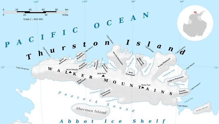
Evans Peninsula (72°1′S 96°47′W) is an ice-covered peninsula about 30 nautical miles (60 km) long, between Koether Inlet and Cadwalader Inlet in the northeast part of Thurston Island. Cape Braathen is an ice-covered cape at the northwest termination of Evans Peninsula. It was discovered in flights from the USS Burton Island and USS Glacier by personnel of the U.S. Navy Bellingshausen Sea Expedition in February 1960, and was named by the Advisory Committee on Antarctic Names for Commander Griffith Evans, Jr., commander of the icebreaker Burton Island during this expedition.
Maps
References
Evans Peninsula Wikipedia(Text) CC BY-SA