
Country France Time zone CET (UTC+1) Area 16.96 km² Population 612 (1999) | Region Occitanie Canton Estaing INSEE/Postal code 12098 / 12190 Local time Wednesday 7:13 AM | |
 | ||
Weather 5°C, Wind NW at 10 km/h, 98% Humidity | ||
Estaing is a commune in the Aveyron department in southern France.
Map of 12190 Estaing, France
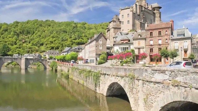
Located in the north of the Aveyron department in the Occitanie region, Estaing is considered as one of the most picturesque villages in France. The village is very quiet during the winter months; it is in the summer that the village shows the most signs of life. Lying at 320 metres above sea level, the winters are cool and the summers are hot and dry. Espalion is a ten-minute drive away, while Rodez is about 50 minutes away.
The bridge over the Lot in Estaing is part of the World Heritage Sites of the Routes of Santiago de Compostela in France.
References
Estaing, Aveyron Wikipedia(Text) CC BY-SA