
Mountain type Karstic Elevation 2,760 m | First ascent Unknown | |
 | ||
Similar Collarada, Peña Telera, Pic d'Arriel, Tendenera, Anayet | ||
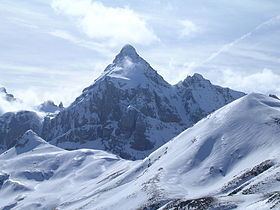
The Escarra Peak (Spanish: Punta Escarra) is a prominent mountain on the Spanish side of the Pyrenees, in the North of Jacetania comarca, in Aragon. The Escarra river has its sources beneath this peak.
Map of Escarra Peak, 65510 Loudenvielle, France
This peak is part of a subrange known as Sierra de la Partacua located in an area of many high peaks.
References
Escarra Peak Wikipedia(Text) CC BY-SA