
Name Erwin Raisz | Books Principles of Cartography | |
Fields Cartography, Geography, Geology | ||
Erwin Raisz (1 March 1893, Lőcse, Hungary – 1 December 1968, Bangkok, Thailand) was a Hungarian-born American cartographer, best known for his physiographic maps of landforms.
Biography
Born in Lőcse, Hungary (now part of Slovakia) in 1893, Raisz was the son of a civil engineer, who introduced him to maps through his work. The son received his degree in civil engineering and architecture from the Royal Polytechnicum in Budapest in 1914, and after serving in the army during World War I, he immigrated to New York in 1923. He worked for the Ohman Map Company while studying for his 1929 Ph.D. at Columbia University. He offered a course in cartography while a student, one of the first such in the United States.
In 1931 he joined the Institute of Geographical Exploration at Harvard University, where he taught cartography and was curator of the map collection for 20 years. He created a significant body of work using hand-drawn pen-and-ink techniques, which during that period were largely being replaced by photo-mechanical processes and scribing. Because they were hand-drawn, his maps and graphics have a distinctive look to them, unique to his hand.
He was author of the first cartography textbook in English, General cartography (1938).
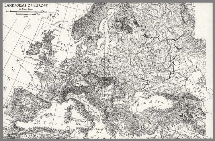
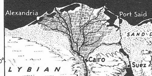
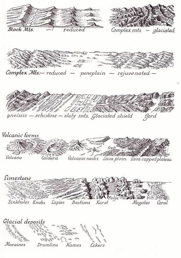
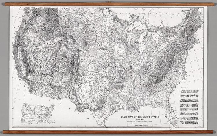
Raisz is best known for his physiographic maps, which describe landforms using his "orthoapsidal" or "armadillo" projection (essentially a small-scale variation on an isometric projection). Created for continents, nations and states, they form a solid corpus of work whose use continues today. Raisz Landform Maps, operated by his family, continues to publish much of his work.