
Official name Embalse de Entrepeñas Status Operational Spillway 1 | Opening date 1956 Impound Tagus | |
 | ||
Similar Tagus, Bolarque Dam, Embalse de Buendía, La Alcarria, Parque Natural del Alto Tajo | ||
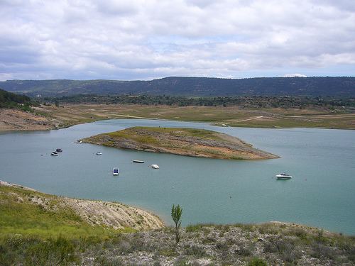
Entrepeñas is a reservoir located on the Tagus River in the Alcarria Baja region of Guadalajara, Spain. It was completed in 1956.
Apart from the Tagus, it also receives water from the Valdetrigo, Barranco Grande, Solana, and Ompólveda rivers, among others. The dam structure is situated next to the town of Entrepeñas, from which it took its name, between the municipal districts of Sacedón and Auñón.
The towns of Auñón, Durón, Pareja, and Sacedón are located on the banks of the reservoir, as are the residential areas of Las Anclas, Las Brisas, Peñalagos, and El Paraiso. Entrepeñas forms part of the so-called Sea of Castile (Spanish: Mar de Castilla), together with the reservoirs of Buendía, Bolarque, Zorita, Almoguera, and Estremera.
The surface area of the reservoir measures 3,213 hectares (12.41 square miles), and it can hold a total of 835,000,000 cubic meters (677,000 acre feet).
In conjunction with the Buendía Reservoir, it supplies the Tagus-Segura Water Transfer.