
Population 250 (2006 census) Postcode(s) 6518 Founded 1961 Postal code 6518 | Established 1961 Elevation 99 m Local time Friday 11:44 PM | |
 | ||
Weather 24°C, Wind SE at 19 km/h, 49% Humidity | ||
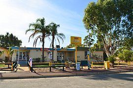
Eneabba is a town on the Brand Highway 278 kilometres (173 mi) north of Perth, Western Australia.
Map of Eneabba WA 6518, Australia
The area is famous for its spectacular display of wildflowers in the spring. It is also home to the Iluka Resources mineral sands facility.
The first European visit to the area was in 1839 by the second disastrous George Grey expedition along the west coast. Grey and his party were forced to walk through the area after their boats were lost. On 11 April, Grey discovered and named the Arrowsmith River, after John Arrowsmith the English cartographer.
In 1870 the first settler, William Horsley Rowland, arrived from Greenough. He took up a 3,000 acre lease at Eneabba Springs and survived by shepherding, trapping horses and pigs and living on wild game.
The area around Eneabba (also known as the Eneabba sandplain) was opened up for agricultural purposes in the 1950s. Much of the land was for a large group of model farms comprising the Eneabba War Service Land Settlement Project. This in turn initiated the need for a town to be developed. The town was gazetted on 27 January 1961.
The name of the town means "ground spring", from the aboriginal name of Eneabba Springs, the site of Rowland's original homestead 14 kilometres (8.7 mi) to the east.