
 | ||
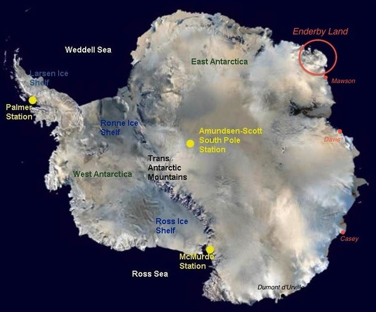
Enderby Land is a projecting land mass of Antarctica, extending from Shinnan Glacier at about 67°55′S 44°38′E to William Scoresby Bay at 67°24′S 59°34′E. It was discovered in February 1831 by John Biscoe in the whaling brig Tula, and named after the Enderby Brothers of London, owners of the Tula, who encouraged their captains to combine exploration with sealing.
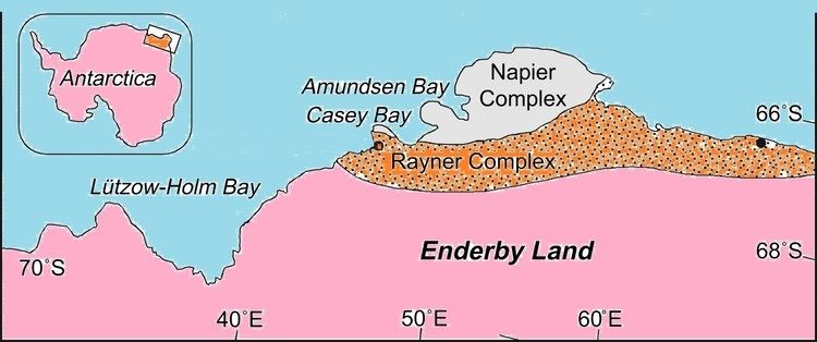
Claimed as part of the Australian Antarctic Territory, geographic features of Enderby Land include Amundsen Bay, Casey Bay, Cape Monakov, the Scott Mountains, the Tula Mountains, and the Napier Mountains. The highest peak is Mount McMaster at 2,830 metres (9,280 ft).
References
Enderby Land Wikipedia(Text) CC BY-SA