Lowest elevation 670 m (2,200 ft) Postal code 500 05 | Highest elevation 720 m (2,360 ft) Time zone EET (UTC+2) Area code(s) +30-2463-xxx-xxx | |
 | ||
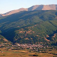
Emporio (Greek: Εμπόριο) is a village and a community of the Eordaia municipality. Before the 2011 local government reform it was part of the municipality of Mouriki, of which it was a municipal district and the seat. The 2011 census recorded 804 inhabitants in the village.
Contents
Map of Emporio 500 05, Greece
History
According to Ottoman document from 1626 to 1627, there were 71 Christian households in the village in the first half of the 17th century.
Notable natives
References
Emporio, Kozani Wikipedia(Text) CC BY-SA
