
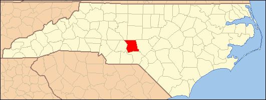
Country United States County Montgomery ZIP code 27281 Elevation 208 m Area code 910 | State North Carolina Time zone Eastern (EST) (UTC-5) Census Code & Class 21210; U6 Local time Thursday 6:59 PM | |
 | ||
Weather 18°C, Wind S at 6 km/h, 22% Humidity | ||
Emery, North Carolina is a populated place in Montgomery County, North Carolina, in the United States. It is located along the co-designated Interstate 73 - Interstate 74, about 50 miles south of Greensboro where the interstates meet U.S. Route 220. It is approximately equidistant between Raleigh to the east and Charlotte to the west. Its ZIP code is 27281. Its elevation is 682 feet above mean sea level.
Map of Emery, NC 27229, USA
Emery itself is not considered a city, town, or village. It is not covered by the United States Census; The nearest census-designated place (CDP) is Candor, located four miles to the north.
References
Emery, North Carolina Wikipedia(Text) CC BY-SA