
Time zone EET (UTC+2) Licence plate 06 Elevation 1,135 m Local time Thursday 3:09 PM | Region Central Anatolia Postal code 06xxx Website www.elmadag.gov.tr Area 573 km² Area code 0312 | |
 | ||
Weather 15°C, Wind SE at 14 km/h, 31% Humidity | ||
Elmadağ is a town and district of Ankara Province in the Central Anatolia region of Turkey. According to 2010 census, population of the district is 43,311 of which 42,099 live in the town of Elmadağ. The district covers an area of 568 km2 (219 sq mi), and the average elevation is 1,135 m (3,724 ft), with the highest point being Mt. İdris at 1,995 m (6,545 ft).
Contents
- Map of ElmadaC49F EdiC49Fe Mahallesi 06780 ElmadaC49F2FAnkara Turkey
- Places of interest
- Towns
- Neighborhoods
- Villages
- References
Map of Elmada%C4%9F, Edi%C4%9Fe Mahallesi, 06780 Elmada%C4%9F%2FAnkara, Turkey
Places of interest
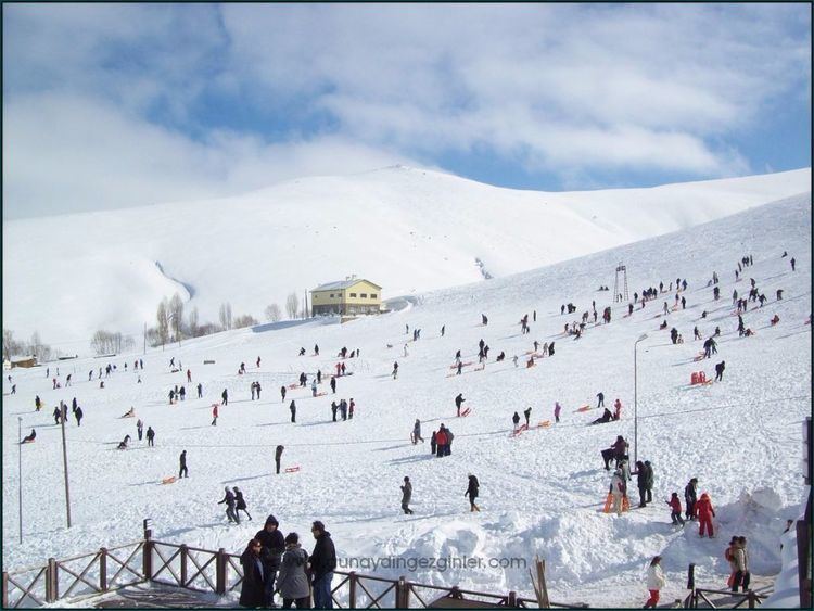
Elmadağ (1,862 m.) is also a small mountain beside the town, 45 km from the cıty of Ankara on the road to Kırıkkale. Residents of Ankara often visit the area for picnics and to learn to ski or snowboard during the skiing season which lasts from December until March. There are hotels, student accommodation, cafes and places selling hot-dogs and other apres-ski food.
Towns
Neighborhoods
Villages
References
Elmadağ, Ankara Wikipedia(Text) CC BY-SA