
OS grid reference SE942280 Sovereign state United Kingdom Postcode district HU15 Dialling code 01482 | Post town BROUGH Local time Thursday 11:20 AM | |
 | ||
Weather 11°C, Wind W at 37 km/h, 61% Humidity | ||
Elloughton is a village in the East Riding of Yorkshire, England. It is situated approximately 12 miles (19 km) to the west of Hull to the south of the A63 road. It lies on the southern end of the Yorkshire Wolds. It is conjoined with Brough that lies to the south-east, with which it forms the civil parish of Elloughton-cum-Brough.
Map of Elloughton, Brough, UK
Elloughton lies within the Parliamentary constituency of Haltemprice and Howden.
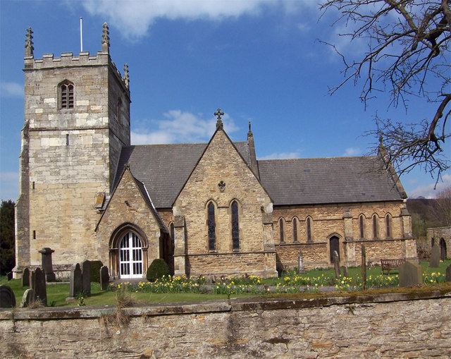
The church dedicated to St Mary was designated a Grade II* listed building in 1968 and is now recorded in the National Heritage List for England, maintained by Historic England.
In 1823 Ellerton was in the Wapentake of Harthill, a part of the Liberty of St Peter's. The patron of the Church of St Mary was the York Minster prebendary of Wetwang. Within the village was a Methodist and a Calvinist chapel. The village had a population of 318, with occupations including six farmers, two carpenters, two tailors, a blacksmith, a shoemaker, and a bricklayer. Also directory-listed were three yeomen, a school master, a gentlewoman, and a curate. Once a week two carriers operated between the village and Hull.