
Location Sunnmøre, Norway Width 2.8 km (1.74 mi) Highest point Myklebosthornet Area 28 km² | Length 16 km (9.9 mi) Highest elevation 329 m (1,079 ft) County Møre og Romsdal | |
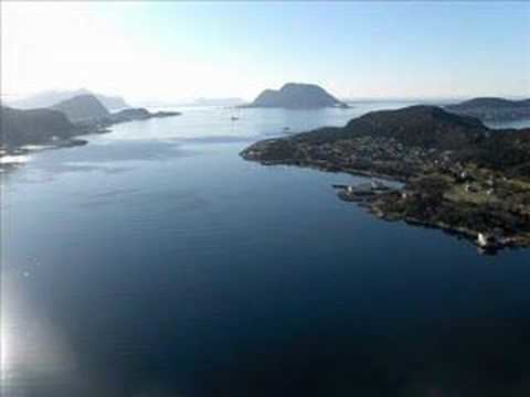 | ||
Ellingsøy or Ellingsøya is the northernmost island in Ålesund Municipality in Møre og Romsdal county, Norway. With an area of 22 square kilometres (8.5 sq mi), Ellingsøy is the second largest island in the municipality after Uksenøya. The island is located northeast of the town of Ålesund, north of the islands of Nørvøya and Uksenøya, east of the island of Valderøya, and south of the mainland peninsula of Haram. The villages of Hoffland, Årset, and Myklebust are all located on the south side of the island. Ellingsøy Church is the main church for the island.
Map of Ellingsoy, 6057 Ellings%C3%B8y, Norway
Ellingsøy used to be accessible from Ålesund only by boat or by road via Skodje Municipality, but the undersea Ellingsøy Tunnel was built in 1987 connecting Ellingsøy to Ålesund (to the south) and the Valderøy Tunnel was also built connecting Ellingsøy to Valderøy in Giske Municipality to the west. The tunnels are accessed in the village of Hoffland on the southwestern part of the island. The 3,481-metre (11,421 ft) long tunnel is currently being upgraded.
Ellingsøy has an association football team, Ellingsøy IL, which currently plays in the 5th division in Norway. Their coach is Dag Rune Skotte.