
- location northeast of Link - location near Kidwell Length 24 km Mouth Point Pleasant Creek | - elevation 1,095 ft (334 m) - elevation 682 ft (208 m) Basin area 54.65 km² Country United States of America | |
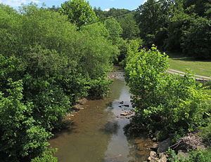 | ||
The Elk Fork is a tributary of Point Pleasant Creek, 14.8 miles (23.8 km) long, in northwestern West Virginia in the United States. Via Point Pleasant Creek, Middle Island Creek, and the Ohio River, it is part of the watershed of the Mississippi River, draining an area of 21.1 square miles (55 km2) in a rural region on the unglaciated portion of the Allegheny Plateau.
Map of Elk Fork, West Virginia, USA
The Elk Fork's entire course and watershed are in Tyler County. It rises approximately 0.7 miles (1.1 km) northeast of Link, and flows generally west-northwestward through the northern part of the county, through the unincorporated communities of Conaway, Iuka, Lonetree, and Polard. It flows into Point Pleasant Creek from the east near the community of Kidwell.
References
Elk Fork (Point Pleasant Creek) Wikipedia(Text) CC BY-SA