
Country United States County Contra Costa ZIP codes 94803, 94820 Elevation 57 m Population 12,669 (2010) | State California Time zone PST (UTC-8) FIPS code 06-22454 Area 7.161 km² Area code Area code 510 | |
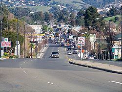 | ||
El Sobrante is a census-designated place (CDP) in Contra Costa County, California, United States. The population was 12,669 at the 2010 census. The Spanish name "El Sobrante" translates to "the leftovers", "remainder" or "surplus land" in English.
Contents
- Map of El Sobrante CA USA
- Geography
- History
- 2010
- 2000
- Education
- Popular culture
- Notable residents
- References
Map of El Sobrante, CA, USA
Geography
According to the United States Census Bureau, the CDP has a total area of 2.8 square miles (7 km2), all of it land.
El Sobrante is unincorporated and lies within Contra Costa County. Main roads include San Pablo Dam Road (a major road running from Richmond and San Pablo, through El Sobrante, past EBMUD's San Pablo Reservoir), Valley View Road and Appian Way. San Pablo Dam Road and Appian Way both connect to Interstate 80 to the west.
El Sobrante also contains San Pablo Creek, running behind the library, ACE hardware store and many homes.
History
Between 5000 and 1000 BC, an indigenous tribe of people called the Huichin, an Ohlone people, came to the East Bay, including El Sobrante. One of the Huichin villages was located where the El Sobrante Library now stands. The Huichin left a now-buried shell mound beside San Pablo Creek.
Between November 1794 and May 1795, the Huichin were forcibly converted to Christianity by Spanish missionaries. After all of the Huichin were removed to Mission San Francisco, they suffered an epidemic of European diseases as well as food shortages, and died in great numbers, resulting in alarming statistics of death and escapes from the missions. In pursuing the runaways, the Franciscans sent neophytes first and (as a last resort) soldiers to go round up the runaway "Christians" from their relatives, and bring them back to the missions. Thus illness spread both inside and outside of the missions.
After Mexican independence from Spain in the early 19th century, Spanish colonists were given land grants, one of which was Rancho El Sobrante, deeded to Juan Jose and Víctor Castro in 1841. The grant's boundaries were unusually complicated, as they were to be determined by the boundaries of the surrounding grants: San Antonio, San Pablo, El Pinole, Boca de la Cañada del Pinole, Acalanes, and La Laguna de los Palos Colorados. In this sense, the rancho was el sobrante, the remaining area. Legal disputes concerning the borders and the claims of squatters continued for four decades, with much of the land sold to pay court and attorney costs. Victor Castro was left with 549 acres (2.22 km2) of the original grant. He built an adobe dwelling in what is now El Cerrito, and became one of the first members of the Board of Supervisors of Contra Costa County. Castro died at the age of 90 in 1897. Some of his descendants still live in the area of Castro Ranch Road.
El Sobrante was called "Oak Grove" by industrial concerns in 1887 when the California and Nevada Railroad put a spur into the area for the purpose of carrying lumber cut from the hills. Then the name Sobrante was applied, with the addition of the Spanish definite article "El" coinciding with the opening of the first post office in 1941.
By the early 20th century, Rancho El Sobrante had been reduced to a number of smaller ranches, generally following a dirt road along San Pablo Creek. Many of these ranches were further subdivided. As roads were paved and homes were constructed, El Sobrante changed from a rural to a semi-rural community.
2010
The 2010 United States Census reported that El Sobrante had a population of 12,669. The population density was 4,581.4 people per square mile (1,768.9/km²). The racial makeup of El Sobrante was 6,405 (50.6%) White, 1,673 (13.2%) African American, 127 (1.0%) Native American, 1,986 (15.7%) Asian, 113 (0.9%) Pacific Islander, 1,384 (10.9%) from other races, and 981 (7.7%) from two or more races. Hispanic or Latino of any race were 3,036 persons (24.0%).
The Census reported that 12,620 people (99.6% of the population) lived in households, 49 (0.4%) lived in non-institutionalized group quarters, and 0 (0%) were institutionalized.
There were 4,759 households, out of which 1,600 (33.6%) had children under the age of 18 living in them, 2,154 (45.3%) were opposite-sex married couples living together, 757 (15.9%) had a female householder with no husband present, 301 (6.3%) had a male householder with no wife present. There were 312 (6.6%) unmarried opposite-sex partnerships, and 67 (1.4%) same-sex married couples or partnerships. 1,170 households (24.6%) were made up of individuals and 373 (7.8%) had someone living alone who was 65 years of age or older. The average household size was 2.65. There were 3,212 families (67.5% of all households); the average family size was 3.16.
The population was spread out with 2,696 people (21.3%) under the age of 18, 1,126 people (8.9%) aged 18 to 24, 3,340 people (26.4%) aged 25 to 44, 3,910 people (30.9%) aged 45 to 64, and 1,597 people (12.6%) who were 65 years of age or older. The median age was 40.6 years. For every 100 females there were 95.1 males. For every 100 females age 18 and over, there were 94.0 males.
There were 5,136 housing units at an average density of 1,857.3 per square mile (717.1/km²), of which 2,952 (62.0%) were owner-occupied, and 1,807 (38.0%) were occupied by renters. The homeowner vacancy rate was 2.0%; the rental vacancy rate was 7.2%. 7,829 people (61.8% of the population) lived in owner-occupied housing units and 4,791 people (37.8%) lived in rental housing units.
2000
As of the 2000 census, there were 12,260 people, 4,676 households, and 3,170 families residing in the CDP. The population density was 3,953.1 people per square mile (1,527.0/km²). There were 4,803 housing units at an average density of 1,548.7 per square mile (598.2/km²). The racial makeup of the CDP was 60.35% White, 12.16% Black or African American, 0.67% Native American, 12.50% Asian, 0.29% Pacific Islander, 6.97% from other races, and 7.06% from two or more races. 15.58% of the population were Hispanic or Latino of any race.
There were 4,676 households, out of which 32.6% had children under the age of 18 living with them, 47.6% were married couples living together, 14.8% had a female householder with no husband present, and 32.2% were non-families. 24.6% of all households were made up of individuals and 8.3% had someone living alone who was 65 years of age or older. The average household size was 2.61 and the average family size was 3.11.
In the CDP, the population was spread out with 24.7% under the age of 18, 7.3% from 18 to 24, 31.0% from 25 to 44, 25.2% from 45 to 64, and 11.8% who were 65 years of age or older. The median age was 38 years. For every 100 females there were 94.1 males. For every 100 females age 18 and over, there were 92.2 males.
The median income for a household in the CDP was $48,272, and the median income for a family was $59,342. Males had a median income of $44,232 versus $34,661 for females. The per capita income for the CDP was $24,525. About 6.6% of families and 9.5% of the population were below the poverty line, including 9.5% of those under age 18 and 10.7% of those age 65 or over.
El Sobrante is also home to a growing Sikh population. The center of the Sikh community is the Gurdwara Sahib of El Sobrante (known for its large golden dome) which sits high in the hills above San Pablo Dam Road.
Education
The El Sobrante Library of the Contra Costa County Library is located in El Sobrante. The library opened in 1961, and in 1975 it received an expansion that doubled the facility's size.
Popular culture
According to Les Claypool on his 1996 song El Sobrante Fortnight, the
Former Green Day drummer John Kiffmeyer took his stage name, "Al Sobrante" from the town. The band Jawbreaker references El Sobrante as "El Sob" in their song Boxcar.
Notable residents
Current and former residents of El Sobrante include the following: