
Local time Tuesday 8:26 PM | ||
 | ||
Weather 0°C, Wind W at 8 km/h, 32% Humidity | ||
El Rito, (Spanish for Little River), is an unincorporated community in Rio Arriba County, New Mexico, USA. Its elevation is 6,875 feet (2,096 m).
Map of El Rito, NM 87530, USA
It is located on NM 554; 18 miles (29 km) NW of Española and 15 miles (24 km) NW of Ojo Caliente.
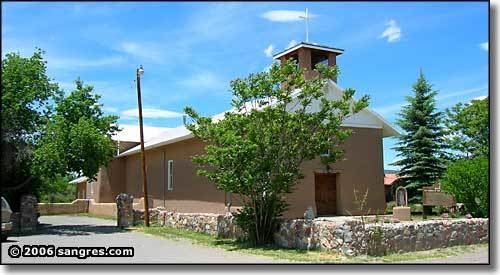
El Rito was one of the first Spanish settlements in northern New Mexico. The oldest church in New Mexico is here. It was restored in the 1980s.
It is the home of the Carson National Forest Service – El Rito Ranger District, the El Rito Public Library, the Las Clinicas del Norte, and a campus of Northern New Mexico College.
Originally named El Rito Colorado, the red creek, it took its name from the creek that passes through the village. Tewas call the El Rito region "pink below place" for the El Rito Mountains, known to them as the pink mountains.
El Rito is surrounded by the Carson National Forest.