
Population 442 (2011 census) State electorate(s) Hinchinbrook Postal code 4855 | Postcode(s) 4855 Elevation 20 m Local time Wednesday 8:04 AM | |
 | ||
Location 1,586 km (985 mi) from Brisbane125 km (78 mi) from Cairns226 km (140 mi) from Townsville Weather 27°C, Wind SW at 3 km/h, 88% Humidity | ||
El Arish is a small town and locality in the Cassowary Coast Region of Queensland, Australia. In the 2011 census, El Arish had a population of 442 people.
Contents
- Map of El Arish QLD 4855 Australia
- History
- Heritage listings
- Economy
- Education
- Amenities
- Past population
- References
Map of El Arish QLD 4855, Australia
History
The town is named after the city of Arish in Egypt where the Australian Light Horse saw action in December 1916 and which was later developed as a major base area with an allied hospital.
The town was founded in 1921 as a soldier settlement area. Many of the streets were named after high-ranking officers, including:
And some were named after general veterans such as:
The El Arish War Memorial is located on the south-west corner of Monash and Ryrie Streets (17.806332°S 146.004821°E / -17.806332; 146.004821 (El Arish War Memorial)).
The Maria Creek State School opened on 13 May 1922; it was renamed El Arish State School in 1925.
El Arish Post Office opened by 1926 (a receiving office had been open from 1921).
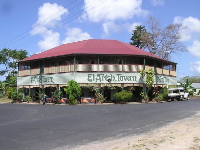
El Arish Tavern was established in 1927.
The area was later settled by Italian Australians who worked in the sugar cane fields.
The town was hit by Severe Tropical Cyclone Yasi in February 2011.
Heritage listings
Heritage-listed places in El Arish include:
Economy
Today, the area is home to a large sugar cane industry and banana plantations.
Education
El Arish State School is a government primary (P-7) school located at 28 Chauvel Street (17.80779°S 146.002822°E / -17.80779; 146.002822 (El Arish State School)).
Amenities
The El Arish Country Golf Club has a 9 hole course and is located on Golf Course Road (17.81007°S 146.00377°E / -17.81007; 146.00377 (El Arish Country Golf Club)).
Past population
At the 2006 census, El Arish had a population of 232.