
Tributaries Right:Shingle Brook Country United States of America | Basin size 15 sq mi (39 km) Length 6 km | |
 | ||
Main source Springs and small ponds above Russell Millpond | ||
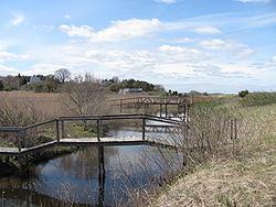
The Eel River is a 3.9-mile (6.3 km) river mostly in the village of Chiltonville in Plymouth, Massachusetts. Its headwaters are springs and small ponds above Russell Millpond. Its watershed encompasses approximately 15 square miles (39 km2). It flows along Plimoth Plantation and Plymouth Beach for about ½ mile before emptying into Plymouth Harbor between the beach and Manters Point.
Contents
Map of Eel River, Plymouth, MA, USA
Crossings
Below is a list of all crossings over the Eel River. The list starts at the headwaters and goes downstream.
Tributaries
Shingle Brook is the only named tributary of the Eel River.
References
Eel River (Massachusetts) Wikipedia(Text) CC BY-SA