
Country United States FIPS code 48-22516 Elevation 198 m Zip code 75439 Local time Friday 10:08 PM | Time zone Central (CST) (UTC-6) GNIS feature ID 1356807 Area 3.04 km² Population 691 (2013) Area code 903 | |
 | ||
Weather 17°C, Wind E at 14 km/h, 55% Humidity | ||
Ector is a city in Fannin County, Texas, United States. The population was 695 at the 2010 census, up from 600 at the 2000 census.
Contents
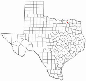
Map of Ector, TX 75439, USA
Geography
Ector is located in western Fannin County at 33°34′39″N 96°16′20″W (33.577470, -96.272284). Texas State Highway 56 runs through the center of town, leading east 6 miles (10 km) to Bonham, the county seat, and west 5.5 miles (8.9 km) to Savoy.
According to the United States Census Bureau, the city has a total area of 1.17 square miles (3.04 km2), all of it land.
Demographics
As of the census of 2000, there were 600 people, 238 households, and 163 families residing in the city. The population density was 507.4 people per square mile (196.3/km2). There were 263 housing units at an average density of 222.4/sq mi (86.1/km2). The racial makeup of the city was 95.33% White, 1.17% Native American, 0.50% Asian, 0.33% from other races, and 2.67% from two or more races. Hispanic or Latino of any race were 1.50% of the population.
There were 238 households out of which 35.3% had children under the age of 18 living with them, 55.9% were married couples living together, 10.5% had a female householder with no husband present, and 31.5% were non-families. 29.0% of all households were made up of individuals and 13.9% had someone living alone who was 65 years of age or older. The average household size was 2.52 and the average family size was 3.13.
In the city, the population was spread out with 30.3% under the age of 18, 4.5% from 18 to 24, 29.0% from 25 to 44, 20.7% from 45 to 64, and 15.5% who were 65 years of age or older. The median age was 35 years. For every 100 females there were 90.5 males. For every 100 females age 18 and over, there were 86.6 males.
The median income for a household in the city was $38,125, and the median income for a family was $46,500. Males had a median income of $30,781 versus $24,063 for females. The per capita income for the city was $15,083. About 2.9% of families and 5.7% of the population were below the poverty line, including 2.8% of those under age 18 and 10.0% of those age 65 or over.
Education
The city of Ector is served by the Ector Independent School District.
History
Ector is located at the intersection of Farm Road 898 and Texas Highway 56, 6 miles (10 km) west of Bonham in west-central Fannin County. The community started in the late nineteenth century when farmers settled near Caney Creek. Residents named it "Victor's Station" but, when informed by postal authorities that a town of that name already existed, decided to honor one of the pioneer settlers of the area, Ector Owens.
In 1886 postal service to the community began. The tracks of the Texas and Pacific Railway reached the site in 1892. The railroad quickly made Ector a shipping point for area farmers. In 1904 the town had 218 residents served by a church, a school, and a half dozen businesses, including a bank. The population reached 451 in 1926, when the businesses numbered 25. In 1947 Ector had a reported 457 residents. Subsequently, the population steadily increased, reaching 650 in 1988. The number of businesses continued to decline, however, from twelve in 1936 to three in 1988. By that time the majority of the residents were commuting to jobs in Sherman, 20 miles (32 km) to the west, and Denison, 22 miles (35 km) to the northwest.