
 | ||
Similar Torndirrup National Park, King George Sound, Patrick Taylor Cottage, West Cape Howe National, Kalgan River | ||
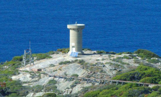
Eclipse Island is a barren island in Western Australia, 17 kilometres (10.6 mi) due south of Albany, and 6.1 km (3.8 mi) south of the nearest point of the mainland coast, which is Cave Point on the southern coast of Torndirrup Peninsula. Eclipse Island Lighthouse is located near the centre of the island. Nearby South West Island contains Western Australia's southernmost landmass.
Contents
Map of Eclipse Island, Western Australia, Australia
Naming
The island was named for an observation on 28 September 1791 by Captain George Vancouver "observed this Wednesday morning a partial solar eclipse. He went on the name the barren rocky cluster of isles."
The island supports a large colony of introduced rabbits and another common introduced pest the arum lily has also been introduced to the island in the past.
The island is composed of granite and has a total area of 99 hectares (245 acres) and was declared a Class 1A Nature Reserve in 2000. It is a waypoint for the Volvo Ocean Race.
The island has a landing stage that is 30 feet (9 m) above the water line to service the 360 feet (110 m) lighthouse which also houses Western Australia's most southerly weather recording station. In 1950 four families were living on the island.
Birds
The island has been classified as an Important Bird Area because it has been reported as supporting over 1% of the world's breeding population of flesh-footed shearwaters (6000-8000 pairs) and great-winged petrels (10,000-15,000 pairs). Other birds that are found on the island include wedge-tailed shearwaters, little shearwaters, Caspian terns and Pacific gulls.