Local time Saturday 2:45 AM | Region Kantō - Tree Box tree Population 127,707 (2010) | |
 | ||
Weather 3°C, Wind NW at 14 km/h, 60% Humidity Points of interest Kenritsu Sagamisansen Park, Ebina Central Park, Sagamikokubunji, Oyakinrin Park, Aruka Shrine | ||
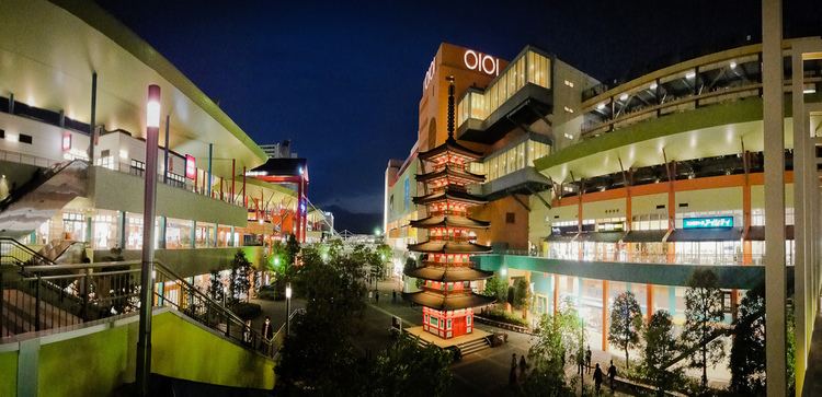
Ebina (海老名市, Ebina-shi) is a city located in central Kanagawa Prefecture, Japan.
Contents
- Map of Ebina Kanagawa Prefecture Japan
- Geography
- Surrounding municipalities
- History
- Economy
- Railway
- Highway
- Local attractions
- Noted people from Ebina
- References
Map of Ebina, Kanagawa Prefecture, Japan
As of February 2015 the city had an estimated population of 129,494 and a population density of 4,870 persons per km². The total area is 26.69 km².
Geography
Ebina is located in the middle of the Sagami Plain, part of western Kantō Plain. The city sits on the eastern bank of the Sagami River. The Tōmei Expressway cuts across the southern end of the city.
Surrounding municipalities
History
The area of modern Ebina has been settled since prehistoric times, and has a number of remains from the Kofun period. Ebina became the provincial capital of Sagami Province in the Nara period, and was the location of the kokubunji, or provincial temple. It was home to the Yokoyama clan, one of the seven warrior clans of the Musashi region during the early Kamakura period. During the Edo period, the lands around Ebina were tenryō territory theoretically administered directly by the Tokugawa Shogunate in Edo; however, in reality, the area was a patchwork of small fiefs held by various hatamoto, as well as exclaves under the control of Sakura Domain and Karasuyama Domain.
After the Meiji Restoration, the area became part of Kōza District, Kanagawa Prefecture and was administratively divided into Ebina Village and Arima Village on April 1, 1889. The area was connected by rail in 1926 via the Sagami Railway and in 1927 by the Odakyu Electric Railway, leading to an increase in population and a change in status of Ebina from village to town in 1940. In 1955, Arima Village merged into Ebina Town. Ebina was elevated to city status on November 1, 1971. Urban development projects in the 1980s and 1990s have modernized the city center.
Economy
Ebina is home to over 150 factories. The town is a center of the production of electrical appliances, metal products, and machinery. The Taito Corporation operates the Ebina Development Center in Ebina. The city was once known for its broad rice paddies, but agriculture now centers on the cultivation of strawberries, tomatoes, and ornamental plants. Ebina serves as a bedroom community to the greater Tokyo and Yokohama area.
