
OS grid reference SP4403 Post town Abingdon Local time Friday 4:25 PM | Sovereign state United Kingdom Postcode district OX13 Dialling code 01865 | |
 | ||
Weather 12°C, Wind S at 11 km/h, 87% Humidity | ||
Eaton is a hamlet about 4.5 miles (7 km) west of Oxford and about 5 miles (8 km) northwest of Abingdon. Eaton is in the civil parish of Appleton-with-Eaton, which is traditionally part of Berkshire, and now in the ceremonial county of Oxfordshire.
Contents
Map of Eaton, Abingdon, UK
History
Eaton is on a single-track road leading to the River Thames at Bablock Hythe, where there was formerly an important vehicular ferry across the river. The village is built on land belonging to St John's College, Oxford.
St John's College, Oxford had the Manor House built in 1677 as a refuge from the Plague for dons. It is now a farmhouse and what had been five farms have been merged into two: Manor Farm and West Farm.
Amenities and public transport
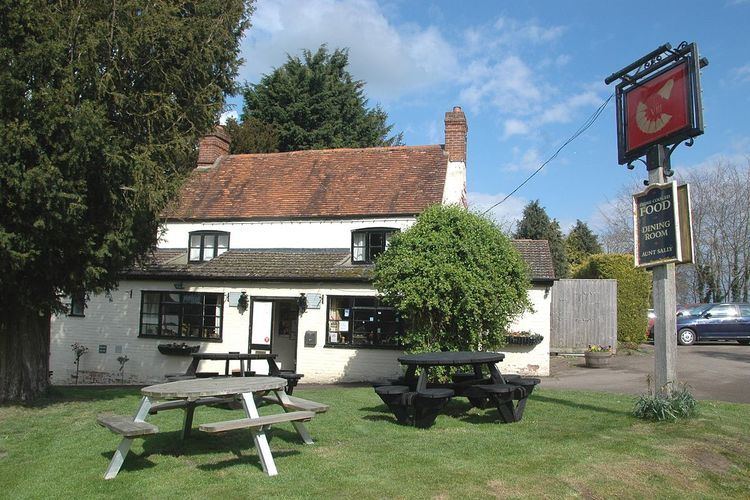
Eaton has a public house, The Eight Bells, which has a darts team and an Aunt Sally team. A ghost called Libby is reputed to haunt the pub.
Oxfordshire County Council bus route 63 runs between Oxford and Southmoor via Eaton three times per day in each direction, every day except Sundays and Bank Holidays. The current contractor operating the route is RH Buses. OCC bus route 43 runs between Eaton and Abingdon once a week in each direction on Thursdays.