
Elevation 1,606 m Local time Friday 7:21 AM | Time zone MST (UTC-7) Zip code 80241 | |
 | ||
Weather -3°C, Wind NW at 6 km/h, 74% Humidity | ||
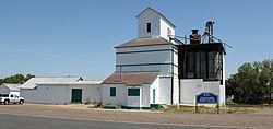
Eastlake is an unincorporated community and a U.S. Post Office in Adams County, Colorado, United States. The Eastlake Post Office has the ZIP Code 80614. Most of the Eastlake area has been annexed by the City of Thornton.
Contents
Map of Eastlake, Thornton, CO 80241, USA
A post office called Eastlake has been in operation since 1912. The community takes its name from nearby East Lake.
Geography
Eastlake is located at 39°55′17″N 104°57′33″W (39.921323,-104.959259).
References
Eastlake, Colorado Wikipedia(Text) CC BY-SA