
Population 911 (2011 census) Postal code 2036 | Postcode(s) 2036 Area 20 ha | |
 | ||
Federal division Division of Kingsford Smith | ||
Eastgardens is a suburb in the Eastern Suburbs of Sydney, in the state of New South Wales, Australia. Eastgardens is located 9 km south of the Sydney central business district and is part of the Bayside Council.
Contents
Map of Eastgardens NSW 2036, Australia
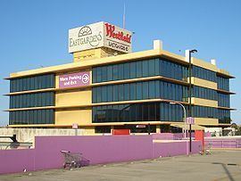
It has a large shopping centre, Westfield Eastgardens at the corner of Wentworth Avenue and Bunnerong Road.
Eastgardens is surrounded by the suburbs of Pagewood, Maroubra, Hillsdale and Banksmeadow.
History
Eastgardens was originally part of the suburb of Pagewood. The suburb took its name from the Westfield Eastgardens shopping centre in Wentworth Avenue which opened in 1987. The site was originally government owned land which was used as a bus depot and also leased to General Motors Holden car manufacturing plant.
References
Eastgardens, New South Wales Wikipedia(Text) CC BY-SA