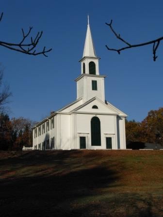
NECTA None Incorporated 1847 Zip code 06242 Local time Friday 9:13 AM | County Windham Elevation 199 m Population 1,761 (2005) | |
 | ||
Region Northeastern Connecticut Weather -2°C, Wind N at 6 km/h, 92% Humidity | ||
Old connecticut path walker road to bigelow brook crossing eastford connecticut
Eastford is a town in Windham County, Connecticut, United States. The population was 1,618 at the 2000 census.
Contents
- Old connecticut path walker road to bigelow brook crossing eastford connecticut
- Map of Eastford CT USA
- History
- Geography
- Principal Communities
- On the National Register of Historic Places
- Demographics
- Education
- Notable people
- Trivia
- References
Map of Eastford, CT, USA
History
Eastford was formed in 1847 when it was broken off from Ashford, Connecticut. It has been a rural community for its whole history.
Geography
According to the United States Census Bureau, the town has a total area of 29.2 square miles (76 km2), of which, 28.9 square miles (75 km2) of it is land and 0.3 square miles (0.78 km2) of it (1.20%) is water.
Principal Communities
On the National Register of Historic Places
Demographics
As of the census of 2000, there were 1,618 people, 618 households, and 451 families residing in the town. The population density was 56.0 people per square mile (21.6/km²). There were 705 housing units at an average density of 24.4 per square mile (9.4/km²). The racial makeup of the town was 97.78% White, 0.43% African American, 0.19% Native American, 0.37% Asian, 0.31% from other races, and 0.93% from two or more races. Hispanic or Latino of any race were 1.36% of the population.
There were 618 households out of which 100 have children under the age of 18 living with them, 63.1% were married couples living together, 6.1% had a female householder with no husband present, and 27.0% were non-families. 21.8% of all households were made up of individuals and 9.1% had someone living alone who was 65 years of age or older. The average household size was 2.62 and the average family size was 3.06.
In the town, the population was spread out with 26.3% under the age of 18, 5.6% from 18 to 24, 29.2% from 25 to 44, 25.4% from 45 to 64, and 13.4% who were 65 years of age or older. The median age was 39 years. For every 100 females there were 103.0 males. For every 100 females age 18 and over, there were 101.0 males.
The median income for a household in the town was $57,159, and the median income for a family was $62,031. Males had a median income of $45,000 versus $31,964 for females. The per capita income for the town was $25,364. About 4.4% of families and 6.0% of the population were below the poverty line, including 10.0% of those under age 18 and 3.7% of those age 65 or over.
Education
Residents are zoned to the Eastford School District for grades Preschool through 8. The only school in the district is Eastford Elementary School. Most high schoolers attend Woodstock Academy. The town is near three alternative high schools: Ellis Vocational Technical School, Windham Technical School and Quinebaug Middle College.
Notable people
Trivia
There was another Eastford in the state which was renamed East Windsor shortly after its separation from Windsor.
