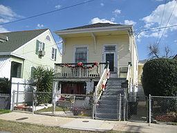
- land 0.25 sq mi (1 km) - summer (DST) CDT (UTC-5) Area code 504 | - water 0.00 sq mi (0 km), 0% Area 65 ha | |
 | ||
Restaurants Atchafala, La Petite Grocery, Cavan, Casamen Restaurant, Mahony's Po‑Boy Shop | ||
East Riverside is a neighborhood of the city of New Orleans. A subdistrict of the Central City/Garden District Area, its boundaries as defined by the City Planning Commission are: Magazine Street to the north, Toledano Street to the east, Tchoupitoulas Street to the south and Napoleon Avenue to the west.
Contents
Map of East Riverside, New Orleans, LA, USA
Geography
East Riverside is located at 29°55′10″N 90°05′40″W and has an elevation of 7 feet (2.1 m). According to the United States Census Bureau, the district has a total land area of 0.25 square miles (0.6 km2), with no bodies of water.
Adjacent Neighborhoods
Demographics
As of the census of 2000, there were 3,220 people, 1,386 households, and 709 families residing in the neighborhood. The population density was 12,880 /mi² (5,367 /km²).
As of the census of 2010, there were 2,699 people, 1,324 households, and 600 families residing in the neighborhood.
