
Country United States County Somerset Incorporated February 18, 1873 Elevation 26 m Local time Friday 2:42 AM Added to NRHP 1983 | State New Jersey Dissolved December 31, 1949 Area 5.946 km² Population 427 (1920) | |
 | ||
Weather 6°C, Wind N at 11 km/h, 53% Humidity | ||
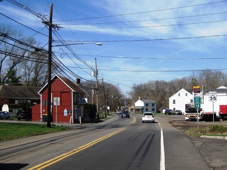
East Millstone is an unincorporated community and census-designated place (CDP) located in Franklin Township, in Somerset County, New Jersey, United States. As of the 2010 United States Census, the CDP's population was 579. It is a small rural community that grew and prospered with a small industrial base in the 19th Century, centered on the Delaware and Raritan Canal at Amwell Road and the long-abandoned Millstone and New Brunswick Railroad that terminated in East Millstone. East Millstone was an independent municipality from 1873–1949.
Contents
- Map of East Millstone Franklin Township NJ 08873 USA
- History
- Geography
- Census 2010
- National Register of Historic Places
- References
Map of East Millstone, Franklin Township, NJ 08873, USA
History
East Millstone existed as an independent municipality for more than 75 years. It was incorporated as a town by an act of the New Jersey Legislature on February 18, 1873, from portions of Franklin Township, and existed on its own until December 31, 1949, when it was returned to Franklin Township.
The independent municipality of Millstone, New Jersey, a borough which is not part of Franklin Township, is located across the Millstone River, which is directly west of the Delaware and Raritan Canal.
East Millstone maintains its rural character into the 21st Century, with a firehouse, a post office and just a handful of local businesses. The housing stock is also quite old, with no new development in the East Millstone section of Franklin Township in recent years.
Geography
According to the United States Census Bureau, East Millstone had a total area of 2.296 square miles (5.946 km2), including 2.234 square miles (5.785 km2) of land and 0.062 square miles (0.161 km2) of water (2.70%).
Census 2010
The 2010 United States Census counted 579 people, 233 households, and 161 families residing in the CDP. The population density was 259.2 per square mile (100.1/km2). The CDP contained 246 housing units at an average density of 110.1 per square mile (42.5/km2). The racial makeup of the CDP was 78.58% (455) White, 10.54% (61) Black or African American, 0.00% (0) Native American, 7.77% (45) Asian, 0.00% (0) Pacific Islander, 0.35% (2) from other races, and 2.76% (16) from two or more races. Hispanics or Latinos of any race were 2.94% (17) of the population.
Out of a total of 233 households, 23.6% had children under the age of 18 living with them, 60.5% were married couples living together, 6.0% had a female householder with no husband present, and 30.9% were non-families. 22.7% of all households were made up of individuals, and 5.2% had someone living alone who was 65 years of age or older. The average household size was 2.48 and the average family size was 2.94.
In the CDP, 16.4% of the population were under the age of 18, 5.0% from 18 to 24, 23.1% from 25 to 44, 39.6% from 45 to 64, and 15.9% who were 65 years of age or older. The median age was 47.5 years. For every 100 females the census counted 101.7 males, but for 100 females at least 18 years old, it was 99.2 males.
National Register of Historic Places
The East Millstone Historic District was added to the National Register of Historic Places in 1983. It is district #83001613.