
Architect Multiple Area 55 ha Added to NRHP 8 September 1983 | NRHP Reference # 83001281 Year built 1812 | |
 | ||
Location Roughly bounded by Park, N. Frontage, Scranton, Sherman, and Elm Sts., New Haven, Connecticut Architectural style Mixed (more than 2 styles from different periods) | ||
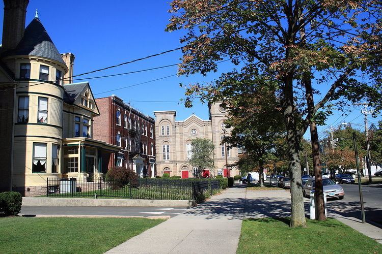
The Dwight Street Historic District is an irregularly shaped 135-acre (55 ha) historic district in New Haven, Connecticut. It was listed on the National Register of Historic Places in 1983. In 1983, out of 629 buildings in the district 595 were deemed contributing buildings. The historic district includes most of the Dwight neighborhood and several blocks of the northeast corner of the West River neighborhood.
The historic district is an irregularly shaped but "roughly square 20-block commercial and residential neighborhood of modest 19th- and early 20th-century structures lying near the center of New Haven, Connecticut." The district is located immediately west of the center of Downtown New Haven and is generally bounded by Whalley Avenue on the north, Park Street on the east, North Frontage Road on the south, and Sherman Avenue on the west.
The district is distinguished by its "high proportion of Victorian dwellings", including many simplified vernacular versions of Federal, Greek Revival, Italianate, Second Empire, Queen Anne and Colonial Revival styles.
Significant contributing buildings in the district include: