
Country United States Time zone Eastern (EST) (UTC-5) Elevation 51 m Population 3,848 (2010) | Incorporation February 17, 1789 Area code(s) 207 Zip code 04222 | |
 | ||
Weather 2°C, Wind SE at 3 km/h, 100% Humidity Area 101.1 km² (99.14 km² Land / 197 ha Water) | ||
Bettie kettell durham maine on the bus
Durham is a town in Androscoggin County, Maine, United States. The population was 3,848 at the 2010 census. It is included in both the Lewiston-Auburn, Maine Metropolitan Statistical Area and the Lewiston-Auburn, Maine Metropolitan New England City and Town Area.
Contents
- Bettie kettell durham maine on the bus
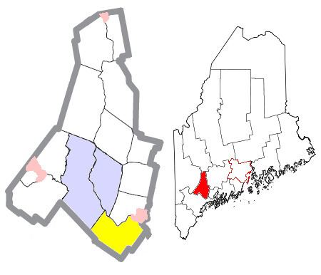
- Map of Durham ME 04222 USA
- History
- Geography
- 2010 census
- 2000 census
- Government
- Education
- Notable people
- References
Map of Durham, ME 04222, USA
History
Durham was named after County Durham, England, the ancestral home of the town's first settler.
Geography
According to the United States Census Bureau, the town has a total area of 39.04 square miles (101.11 km2), of which 38.28 square miles (99.14 km2) is land and 0.76 square miles (1.97 km2) is water.
Durham is bordered by Pownal, Auburn, Freeport, New Gloucester, Brunswick, Lewiston, Lisbon Falls, and Topsham.
Durham is considered a "gateway" town because it connects two major Maine communities, the Greater Portland Area with the Lewiston–Auburn Area.
2010 census
As of the census of 2010, there were 3,848 people, 1,496 households, and 1,143 families residing in the town. The population density was 100.5 inhabitants per square mile (38.8/km2). There were 1,548 housing units at an average density of 40.4 per square mile (15.6/km2). The racial makeup of the town was 97.8% White, 0.3% African American, 0.1% Native American, 0.5% Asian, 0.2% from other races, and 1.0% from two or more races. Hispanic or Latino of any race were 0.8% of the population.
There were 1,496 households of which 33.5% had children under the age of 18 living with them, 63.6% were married couples living together, 7.5% had a female householder with no husband present, 5.3% had a male householder with no wife present, and 23.6% were non-families. 16.6% of all households were made up of individuals and 4% had someone living alone who was 65 years of age or older. The average household size was 2.57 and the average family size was 2.85.
The median age in the town was 41.2 years. 22.3% of residents were under the age of 18; 5.5% were between the ages of 18 and 24; 29.1% were from 25 to 44; 33.8% were from 45 to 64; and 9.3% were 65 years of age or older. The gender makeup of the town was 50.6% male and 49.4% female.
2000 census
As of the census of 2000, there were 3,381 people, 1,226 households, and 980 families residing in the town. The population density was 88.7 people per square mile (34.3/km²). There were 1,257 housing units at an average density of 33.0 per square mile (12.7/km²). The racial makeup of the town was 98.96% White, 0.12% African American, 0.15% Native American, 0.27% Asian, 0.09% from other races, and 0.41% from two or more races. Hispanic or Latino of any race were 0.65% of the population.
There were 1,226 households out of which 38.9% had children under the age of 18 living with them, 70.6% were married couples living together, 5.9% had a female householder with no husband present, and 20.0% were non-families. 12.4% of all households were made up of individuals and 3.0% had someone living alone who was 65 years of age or older. The average household size was 2.75 and the average family size was 3.02.
In the town, the population was spread out with 26.9% under the age of 18, 5.2% from 18 to 24, 35.5% from 25 to 44, 25.5% from 45 to 64, and 6.8% who were 65 years of age or older. The median age was 37 years. For every 100 females there were 99.5 males. For every 100 females age 18 and over, there were 99.2 males.
The median income for a household in the town was $53,846, and the median income for a family was $55,028. Males had a median income of $35,174 versus $28,342 for females. The per capita income for the town was $20,883. About 5.9% of families and 6.6% of the population were below the poverty line, including 8.2% of those under age 18 and 9.8% of those age 65 or over.
Voter registration
Government
Durham is in the Maine's 2nd US Congressional District, Maine Senate District 22, and Maine House of Representatives District 46.