
OS grid reference SX048678 Post town BODMIN Dialling code 01208 | Sovereign state United Kingdom Postcode district PL31 | |
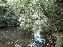 | ||
Dunmere is a hamlet in Cornwall, England, United Kingdom. It is situated one mile northwest of Bodmin in the valley of the River Camel on the A389 road.
Map of Dunmere, Bodmin, UK
The former branch of the Bodmin and Wenford Railway to Wenfordbridge crossed the A389 road at Dunmere. This section of the railway now forms part of the Camel Trail, a long-distance footpath and cycle trail.
Boscarne Junction railway station, the current terminus of the railway, is situated a mile (1.6 km) west of Dunmere.
Dunmere has a pub, The Borough Arms.
References
Dunmere, Cornwall Wikipedia(Text) CC BY-SA