
 | ||
Dundurn Street is a Lower City arterial road in Hamilton, Ontario, Canada. It is a two-way street that starts off at Mountain Face Park, Niagara Escarpment in front of the Bruce Trail as a collector road, right behind Hillcrest Avenue and then turns into a four lane thoroughfare from Aberdeen Avenue northward to York Boulevard where it ends in front of Dundurn Park.
Contents
- History
- Bruce Trail
- Landmarks
- Communities
- Major roads that cross Dundurn Street
- Roads that are parallel with Dundurn Street
- References
The section of Dundurn Street north of Main Street was designated as part of Highway 2, until January 1, 1998.
History
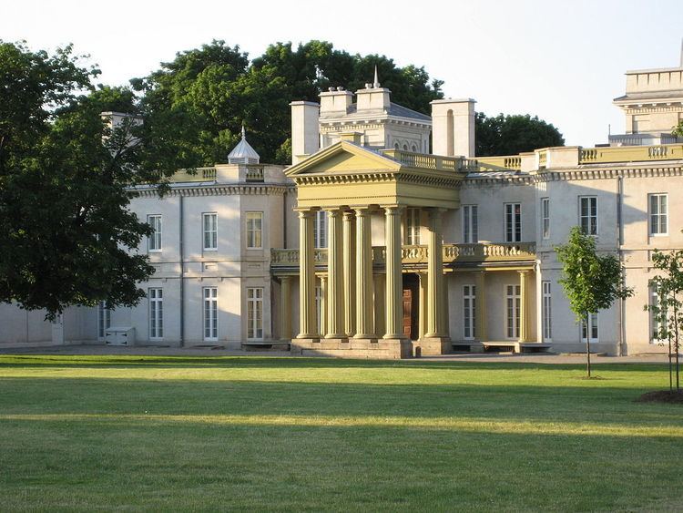
Dundurn Street, originated with Sir Allan MacNab who named his home Dundurn Castle and its landscaped grounds Dundurn Park. Originally Dundurn Street, South of King Street West was known as Garth Street up to 1913. Dundurn is a Gaelic word meaning "the fort on the water." (sic - This is a persistent incorrect translation perpetuated in many historical works about Dundurn Castle. The original source of the error is not known. Dundurn actually derives from the Gaelic words dùn meaning "hill fort" and dòrn meaning "fist", thus Dundurn means "hill fort of a fist". It is named after Sir Allan MacNab's ancestral family home in Dundurn, Perthshire, Scotland, just east of Loch Earn, which was the site of an ancient Pictish hill fort named Dùn Dòrn. So named because the hill upon which it sat is shaped like a fist. There are many Gaelic words referring to water, none of which resembles the place name element durn. The erroneous translation "fort on the water" likely derives from a confusion with the Scots word burn, which means "creek" and is not a Gaelic word at all. - citation to be added shortly) Originally, Dundurn Street was called Garth Street.
The Hamilton Military Museum opened in 1976 and is situated inside Dundurn Park adjacent to Dundurn Castle. It tells the story of the service given by citizens of the Hamilton area from the time of the American Revolution to World War II.
The Staircase originally was opened by Hugh MacLeod in 1998. The Staircase evolved and expanded from an improvisational comedy workshop to include an art gallery, a cafe, a theatre for film and live acts, and a rehearsal space. A former variety store next door was also acquired.
Bruce Trail
One can reach the Bruce Trail via the stairway on Dundurn Street South. The trail cuts through the city along the Niagara Escarpment (mountain) and used by many locals for a full days hike. The Trail is 430 miles long and starts at Niagara Falls, passes through Hamilton and ends at the Bruce Peninsula. Hikers are led to scenic gorges, hidden waterfalls and places of quiet charm.
Landmarks
Note: Listing of Landmarks from North to South.
Communities
Note: Listing of neighbourhoods from North to South
Major roads that cross Dundurn Street
Note: Listing of streets from North to South.
Roads that are parallel with Dundurn Street
Note: Listing of streets from West to East.