
Time zone Central (CST) (UTC-6) Elevation 50 m Population 4,538 (2013) Area code 870 | Townships Randolph, Walnut Lake ZIP code(s) 71639, 71662 Area 8.4 km² Local time Tuesday 4:32 PM | |
 | ||
Weather 18°C, Wind NW at 11 km/h, 40% Humidity | ||
Dumas is a city in Desha County, Arkansas. The population was 4,706 at the 2010 census.
Contents
- Map of Dumas AR USA
- Geography
- Climate
- Demographics
- History
- Education
- Highways
- Notable residents
- In popular culture
- References
Map of Dumas, AR, USA
Geography
Dumas is located in northwestern Desha County at 33°53′12″N 91°29′19″W (33.886626, -91.488544). According to the United States Census Bureau, the city has a total area of 3.2 square miles (8.4 km2), all of it land. The city is located in the Delta Lowlands sub-region of the Arkansas Delta with a topography that is largely flat.
Climate
The climate in the area is characterized by hot, humid summers and generally mild to cool winters. According to the Köppen Climate Classification system, Dumas has a humid subtropical climate, abbreviated "Cfa" on climate maps.
Demographics
As of the census of 2000, there were 5,238 people, 1,977 households, and 1,399 families residing in the city. The population density was 1,768.0 people per square mile (683.2/km²). There were 2,177 housing units at an average density of 734.8 per square mile (284.0/km²). The racial makeup of the city was 26.62% White, 70.02% Black or African American, 0.08% Native American, 0.50% Asian, 2.00% from other races, and 0.78% from two or more races. 3.19% of the population were Hispanic or Latino of any race.
There were 1,977 households out of which 36.4% had children under the age of 18 living with them, 43.9% were married couples living together, 23.4% had a female householder with no husband present, and 29.2% were non-families. 27.4% of all households were made up of individuals and 12.9% had someone living alone who was 65 years of age or older. The average household size was 2.63 and the average family size was 3.19.
In the city, the population was spread out with 30.1% under the age of 18, 10.7% from 18 to 24, 24.9% from 25 to 44, 21.2% from 45 to 64, and 13.1% who were 65 years of age or older. The median age was 33 years. For every 100 females there were 83.9 males. For every 100 females age 18 and over, there were 78.3 males.
The median income for a household in the city was $25,754, and the median income for a family was $32,255. Males had a median income of $28,396 versus $19,363 for females. The per capita income for the city was $12,727. About 22.6% of families and 28.8% of the population were below the poverty line, including 39.9% of those under age 18 and 23.4% of those age 65 or over.
History
Dumas proudly proclaims itself as "Home of the Ding Dong Daddy", a reference to the vaudeville song "I'm a Ding Dong Daddy from Dumas" by Phil Baxter. However, this is up for debate, as the city of Dumas, Texas, also lays claim, with some documentation, to the song being about them.
On February 24, 2007, Dumas was struck by a tornado at around 3 p.m. CT (4 p.m. ET). More than 40 people were injured and many homes and business were damaged or destroyed. The local Dumas police stated on CNN that "the feed mill was the local employer and now it is gone". Following the storm, U.S. Senator Mark Pryor had criticized the Federal Emergency Management Agency's response to the recovery and cleanup efforts.
Education
Dumas is served by the Dumas School District.
Highways
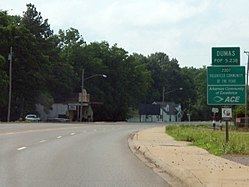
U.S. Route 65 passes through the city, leading northwest 41 miles (66 km) to Pine Bluff and south (with U.S. Route 165) 19 miles (31 km) to McGehee. US 165 leads northeast from Dumas 34 miles (55 km) to DeWitt.
Notable residents
In popular culture
In September 2011 the feature film Mud, written and directed by Jeff Nichols and starring Reese Witherspoon and Matthew McConaughey, was filmed in and around Dumas. Several townspeople served as extras in the film, with a few having acquired small speaking roles.