
Country United States Area code(s) 539/918 Elevation 259 m Zip code 74030 University Central Technology Center | Time zone Central (CST) (UTC-6) FIPS code 40-21750 Local time Tuesday 2:04 AM Population 2,899 (2013) | |
 | ||
Weather 11°C, Wind NW at 14 km/h, 19% Humidity Area 19.5 km² (19.45 km² Land / 5 ha Water) | ||
Drumright oklahoma high school 50th reunion slideshow may 28 2016
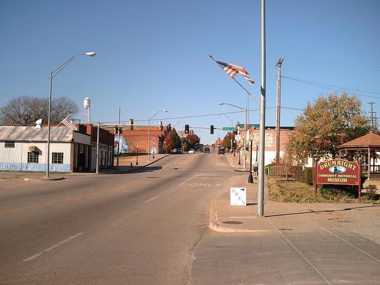
Drumright is a city in Creek and Payne counties in the U.S. state of Oklahoma. It began as an oil boom town. However, the population has declined as oil production has waned in the area. The population was 2,907 at the 2010 census, almost unchanged from 2,905 at the 2000 census. Drumright and nearby Cushing were at the center of a large, productive oilfield in the 1910s and 1920s.
Contents
- Drumright oklahoma high school 50th reunion slideshow may 28 2016
- Map of Drumright OK 74030 USA
- Drumright oklahoma 1940s pt 1
- History
- Geography
- Demographics
- Government
- Economy
- References
Map of Drumright, OK 74030, USA
Drumright oklahoma 1940s pt 1
History
The town sprang up nearly overnight in 1912, after wildcatter Tom Slick struck oil on the farm of Frank Wheeler, causing a rush of speculators, oilfield workers, and merchants into the area. A post office was established in the community on December 28, 1912. Local landowners James W. Fulkerson and Aaron Drumright platted a townsite, which was initially called Fulkerson, The town was renamed for Aaron Drumright, a farmer and later local businessman whose farm was part of the townsite.
Oil workers flooded into town so quickly that they lived in tents or shacks made from box cars, causing the community to be known locally as "Ragtown." Hotels and boarding houses were constructed next, as well as amenities like gambling dens, dance halls, and roadhouses, where the workers could spend their money. Drumright incorporated as a town on May 27, 1913. In 1914, the city built a two-story building of stone to serve as an elementary and high school. It was called Washington School, and is listed on the National Register of Historic Places (NRIS 81000462). Two banks opened in the town during 1914. Drumright was designated a first-class city after an election on April 18, 1916. The 1920 census reported a population of 6,460.
The Oil Fields and Santa Fe Railway built a track from Frey Junction (south of Oilton) to Drumright in 1915. The following year the Atchison, Topeka & Santa Fe Railroad (AT&SF) built a line north from Shamrock to Drumright. The AT&SF also acquired the Oil Fields and Santa Fe Railway.
In 1919 a riot broke out in Drumright during a strike by telephone workers. The town's mayor and chief of police were locked in the town jail by rioters. The Governor of Oklahoma sent six militia units to town to restore order.
Beginning with the Depression of the 1930s, the town declined as oil production waned, and a large refinery at the edge of town closed in the 1950s.
Tornadoes have caused loss of life and property damage in Drumright on at least two occasions: on April 2, 1956, when five people were killed and several homes, a school, and the public library were damaged; and on June 8, 1974, when 12 people were killed, a nursing home was destroyed, and about 100 homes were damaged or destroyed.
Geography
Drumright is located in western Creek County at 35°59′17″N 96°36′2″W (35.988168, -96.600570). A small portion of the city extends west into Payne County. Drumright is 26 miles (42 km) west of Sapulpa and 42 miles southwest of Tulsa at the junction of State Highways 16, 33 and 99. According to the United States Census Bureau, the city has a total area of 7.5 square miles (19.5 km2), of which 0.02 square miles (0.04 km2), or 0.19%, is water.
Demographics
As of the census of 2000, there were 2,905 people, 1,209 households, and 790 families residing in the city. The population density was 411.8 people per square mile (159.1/km²). There were 1,378 housing units at an average density of 195.4 per square mile (75.5/km²). The racial makeup of the city was 84.44% White, 0.93% African American, 8.47% Native American, 0.03% Asian, 0.17% from other races, and 5.96% from two or more races. Hispanic or Latino of any race were 0.90% of the population.
There were 1,209 households out of which 29.9% had children under the age of 18 living with them, 47.5% were married couples living together, 14.2% had a female householder with no husband present, and 34.6% were non-families. 31.0% of all households were made up of individuals and 16.5% had someone living alone who was 65 years of age or older. The average household size was 2.34 and the average family size was 2.92.
In the city, the population was spread out with 25.5% under the age of 18, 8.0% from 18 to 24, 25.2% from 25 to 44, 20.3% from 45 to 64, and 20.9% who were 65 years of age or older. The median age was 38 years. For every 100 females there were 87.5 males. For every 100 females age 18 and over, there were 81.2 males.
The median income for a household in the city was $27,292, and the median income for a family was $34,761. Males had a median income of $30,069 versus $20,123 for females. The per capita income for the city was $14,511. About 13.7% of families and 17.3% of the population were below the poverty line, including 19.7% of those under age 18 and 11.0% of those age 65 or over.
Government
Drumright has a council-manager form of government. The current Mayor is Deborah Guillot Bright, the Vice Mayor is Danny Cooper.
Economy
Today, oil, gas and agriculture are the largest local industries. Drumright is also home to an area vocational and technical school, Central Technology Center, which opened August 22, 1970, and employs about 125 people. More recently, Tidewater Winery opened in a historic building that once served as a school for the children of refinery workers.