
NRHP Reference # 12001006 | Added to NRHP 10 October 2012 | |
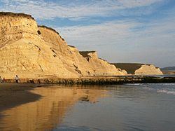 | ||
Drakes Bay is a small bay in the Point Reyes National Seashore on the coast of northern California in the United States, approximately 30 miles (48 km) northwest of San Francisco at approximately 38 degrees north latitude. The bay is approximately 8 miles (13 km) wide. It is formed on the lee side of the coastal current by Point Reyes. The portions of the bay related to Francis Drake's 1579 visit, Sebastião Rodrigues Soromenho's 1595 visit and their interactions with the Coast Miwok were designated as the Drakes Bay Historic and Archaeological District, a National Historic Landmark, on October 17, 2012.
Map of Drakes Bay, California, USA
The bay is fed by Drake's Estero, an expansive estuary on the Point Reyes peninsula. The estuary is protected by Estero de Limantour State Marine Reserve & Drakes Estero State Marine Conservation Area. Point Reyes State Marine Reserve & Point Reyes State Marine Conservation Area lie within Drakes Bay. Like underwater parks, these marine protected areas help conserve ocean wildlife and marine ecosystems.
The bay is named after Sir Francis Drake and has long been considered Drake's most likely landing spot on the west coast of North America during his circumnavigation of the world by sea in 1579. An alternative name for this bay is Puerto De Los Reyes.