
Area 23,481 km² | Time zone GMT (UTC+0) Local time Friday 10:42 PM | |
 | ||
Weather 26°C, Wind NE at 11 km/h, 10% Humidity | ||
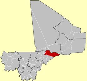
Douentza Cercle is an administrative subdivision of the Mopti Region of Mali. The administrative center (chef-lieu) is the town of Douentza.
Map of Douentza, Mali
During the Tuareg rebellion of 2012, it was the southernmost part of the state of Azawad, according to the April 2012 MNLA's territorial claim. From June 2012 it was claimed by a series of rival Islamist and local militias.
The route of the annual circular migration of the Gourma elephants crosses a number of communes in the cercles of Douentza and Gourma-Rharous (Tombouctou Region).
The cercle is divided into 15 communes:
References
Douentza Cercle Wikipedia(Text) CC BY-SA