
Elevation 36 m Zip code 93620 Area code 209 | Incorporated May 24, 1935 FIPS code 06-19612 Area 3.496 km² Population 5,057 (2013) Local time Friday 11:05 AM | |
 | ||
Weather 17°C, Wind N at 3 km/h, 74% Humidity | ||
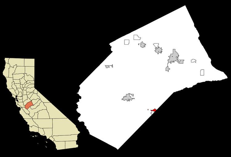
Dos Palos (formerly, Colony Center) is a city in Merced County, California, United States. Dos Palos is located 23 miles (37 km) south-southwest of Merced, at an elevation of 118 feet (36 m). The population was 4,950 at the 2010 census, up from 4,581 at the 2000 census.
Contents
Map of Dos Palos, CA 93620, USA
Geography
Dos Palos is located at 36°59′N 120°38′W.
According to the United States Census Bureau, the CDP covers an area of 1.35 square miles (3.5 km2), all of it land.
History
In one of his expeditions (1820's) along the westside of the San Joaquin Valley, explorer Gabriel Moraga reported the location of two large isolated poplar trees, which he called "Dos Palos." In 19th Century Spanish usage, "palos" was used to describe tall pole-like trees or "timbers". 21st century usage often translates it as "sticks." The "Rancho Sanjon de Santa Rita" Mexican Land Grant cites "Los Dos Palos" or "The Two Trees" as a boundary marker. In 1891, former school superintendent Bernhard Marks convinced cattle ranch king Henry Miller to develop a small town nearby. They gave it the name "Dos Palos Colony" but pronounced it with their Alsatian German accent as "Dahce Palace." This pronunciation remained for over one hundred years until a recent Spanish pronunciation revival. Marks brought forty pioneer families west from Iowa and Nebraska to establish the community. In 1892, unable to find good water, many of the settlers left. Marks convinced Miller to establish another town two miles away on land unsuitable for farming and ranching due to swamps and unsettling soils. Some of the settlers relocated. This new town was named Colony Center, California. In 1906, Dos Palos Colony was renamed South Dos Palos and Colony Center was renamed Dos Palos. The Post Office was briefly misspelled as one word, "Dospalos" but this was changed within a year. About a dozen of the colony's original families still reside locally. Through the years, people from many other locations joined the community. Dos Palos incorporated in 1935.
On 1 January 2008 6.52 sq mi (16.89 km2) surrounding the community of Dos Palos were transferred from Fresno County to Merced County.
2010
The 2010 United States Census reported that Dos Palos had a population of 4,950. The population density was 3,667.3 people per square mile (1,416.0/km²). The racial makeup of Dos Palos was 3,377 (68.2%) White, 167 (3.4%) African American, 62 (1.3%) Native American, 37 (0.7%) Asian, 4 (0.1%) Pacific Islander, 1,075 (21.7%) from other races, and 228 (4.6%) from two or more races. Hispanic or Latino of any race were 3,075 persons (62.1%).
The Census reported that 4,922 people (99.4% of the population) lived in households, 0 (0%) lived in non-institutionalized group quarters, and 28 (0.6%) were institutionalized.
There were 1,501 households, out of which 731 (48.7%) had children under the age of 18 living in them, 816 (54.4%) were opposite-sex married couples living together, 232 (15.5%) had a female householder with no husband present, 130 (8.7%) had a male householder with no wife present. There were 119 (7.9%) unmarried opposite-sex partnerships, and 7 (0.5%) same-sex married couples or partnerships. 261 households (17.4%) were made up of individuals and 116 (7.7%) had someone living alone who was 65 years of age or older. The average household size was 3.28. There were 1,178 families (78.5% of all households); the average family size was 3.69.
The population was spread out with 1,571 people (31.7%) under the age of 18, 532 people (10.7%) aged 18 to 24, 1,199 people (24.2%) aged 25 to 44, 1,114 people (22.5%) aged 45 to 64, and 534 people (10.8%) who were 65 years of age or older. The median age was 31.3 years. For every 100 females there were 96.1 males. For every 100 females age 18 and over, there were 96.1 males.
There were 1,700 housing units at an average density of 1,259.5 per square mile (486.3/km²), of which 929 (61.9%) were owner-occupied, and 572 (38.1%) were occupied by renters. The homeowner vacancy rate was 3.2%; the rental vacancy rate was 8.9%. 2,955 people (59.7% of the population) lived in owner-occupied housing units and 1,967 people (39.7%) lived in rental housing units.
2000
As of the census of 2000, there were 4,581 people, 1,424 households, and 1,116 families residing in the city. The population density was 3,075.7 people per square mile (1,187.1/km²). There were 1,491 housing units at an average density of 1,001.1 per square mile (386.4/km²). The racial makeup of the city was 39.80% White, 4.15% Black or African American, 1.38% Native American, 0.61% Asian.54.18% of the population were Hispanic or Latino of any race.
There were 1,424 households out of which 45.6% had children under the age of 18 living with them, 58.5% were married couples living together, 14.7% had a female householder with no husband present, and 21.6% were non-families. 18.7% of all households were made up of individuals and 8.8% had someone living alone who was 65 years of age or older. The average household size was 3.20 and the average family size was 3.63.
In the city, the population was spread out with 34.9% under the age of 18, 8.8% from 18 to 24, 26.8% from 25 to 44, 19.0% from 45 to 64, and 10.4% who were 65 years of age or older. The median age was 30 years. For every 100 females there were 97.5 males. For every 100 females age 18 and over, there were 92.4 males.
The median income for a household in the city was $29,147, and the median income for a family was $35,906. Males had a median income of $30,568 versus $20,960 for females. The per capita income for the city was $13,163. About 19.1% of families and 22.8% of the population were below the poverty line, including 31.9% of those under age 18 and 10.9% of those age 65 or over.
Government
In the California State Legislature, Dos Palos is in the 12th Senate District, represented by Republican Anthony Cannella, and the 21st Assembly District, represented by Democrat Adam Gray.
In the United States House of Representatives, Dos Palos is in California's 16th congressional district, represented by Democrat Jim Costa.
Members of the Dos Palos City Council serve four year terms. The 91st and current panel consists of:Template:Citation needed per City Clerk, City of Dos Palos