
Population 3,105 (2011 census) Postcode(s) 4077 Founded 1976 | Established 1976 Postal code 4077 | |
 | ||
State electorate(s) Electoral district of Algester | ||
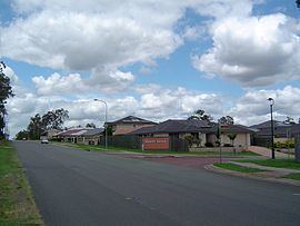
Doolandella is an outer suburb of Brisbane, Australia. It is 17 kilometres (11 mi) south-west of the Brisbane central business district. It was declared as an official suburb in 1976. The name Doolandella, or Dulandella as expressed by Aborigines, refers to the Geebung tree, a broad leaved shrub with yellow fruit which grows in the area.
Contents
Map of Doolandella QLD 4077, Australia
In 2004, a total of 70 houses with a population of 255 was recorded in the suburb. At the 2011 Australian Census the suburb recorded a population of 3,105 with the number of occupied dwellings rising significantly to 934.
The suburb has good access to the Ipswich Motorway via Blunder Road as well as the Logan Motorway to the south.
Demographics
In the 2011 census, Doolandella recorded a population of 3,105 people, 49% female and 51% male.
The median age of the Doolandella population was 30 years of age, 7 years below the Australian median.
55.6% of people living in Doolandella were born in Australia, compared to the national average of 69.8%; the next most common countries of birth were Vietnam 11.9%, New Zealand 5.6%, India 2.9%, England 2.1%, Fiji 1.7%.
53.3% of people spoke only English at home; the next most popular languages were 19.5% Vietnamese, 2.7% Samoan, 2.3% Hindi, 2.1% Mandarin, 1.9% Spanish.