
OS grid reference SU854020 Sovereign state United Kingdom Area 4.52 km² Dialling code 01243 | Civil parish Donnington Post town CHICHESTER Population 2,059 (2011) | |
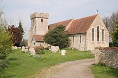 | ||
Donnington is a small village and civil parish in the Chichester district of West Sussex, England. The village lies on the B2201 road, two miles (3 km) south of Chichester. The northern part of the parish comprises the Stockbridge area of the City of Chichester.
Contents
Map of Donnington, UK
The village lies on the Chichester Canal. The parish is also home to the Sussex Falconry Centre.
Governance
An electoral ward in the same name exists. This ward includes Appledram and at the 2011 census had a population of 2,228.
References
Donnington, West Sussex Wikipedia(Text) CC BY-SA