
OSI/OSNI grid C758178 Province Ulster | Elevation 399 m Listing Marilyn | |
 | ||
Similar Lougher, Slieve Snaght, Raghtin More, Tievebulliagh, Slieve Muck | ||
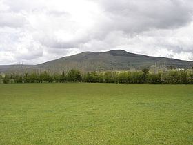
Donald's Hill (Irish: Cnoc Dhónaill) is a hill in County Londonderry, Northern Ireland. The summit reaches 399 metres above sea level and classifies as a Marilyn. Located at the edge of the Sperrin Mountains, the town of Drumsurn sits at the foot of the hill.
Contents
Map of Donald's Hill, Limavady, UK
The Ordnance Survey Memoirs of 1834 records an alternative name of Knocknahurkle, which is believed to be derived from Irish Cnoc na hEarcola.
An ignimbrite formation can be found at the western edge of the plateau with approximately 30 kilometres of outcrop between Donald's Hill and Magherafelt.
Links
References
Donald's Hill Wikipedia(Text) CC BY-SA