
District Žďár nad Sázavou Elevation 502 m | Postal code 592 51 Area 4.46 km² | |
 | ||
Website | ||
Dolní Rožínka is a village and municipality (obec) in Žďár nad Sázavou District in the Vysočina Region of the Czech Republic.
Map of 592 51 Doln%C3%AD Ro%C5%BE%C3%ADnka, Czechia
The municipality covers an area of 4.46 square kilometres (1.72 sq mi), and has a population of 630 (as at 1. 1. 2014).
Dolní Rožínka lies approximately 22 kilometres (14 mi) south-east of Žďár nad Sázavou, 46 km (29 mi) east of Jihlava, and 146 km (91 mi) south-east of Prague.
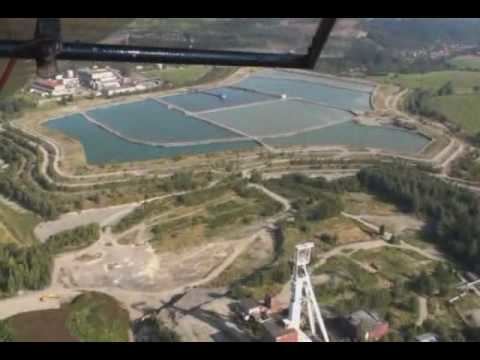
The village hosts the only currently-operational uranium mine and processing mill in the Czech Republic.
References
Dolní Rožínka Wikipedia(Text) CC BY-SA