
Max. length 199 yd (182 m) Average depth 49 ft (15 m) Mean depth 15 m Width 149 m | Max. width 163 yd (149 m) Surface elevation 2,530 m Length 182 m | |
 | ||
Location | ||
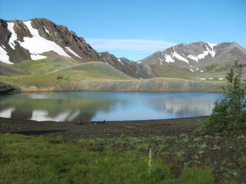
Dollar Lake is a small tarn located on Aneroid Mountain in the Eagle Cap Wilderness of Northeastern Oregon, United States. It is between Aneroid Lake and Bonny Lakes and lies 1 mile (1.6 km) southwest of Aneroid Peak. It likely received its name because of its size and its almost perfectly round shape, much like that of a silver dollar. It is the fifth-highest lake in the Eagle Cap Wilderness.
Contents
Map of Dollar Lake, Oregon 97846, USA
Trail
Dollar Lake can be accessed by Trail 1802. The route from Tenderfoot Trailhead or Tenderfoot Wagon Road Trail passes Bonny Lakes about 1.8 miles (2.9 km) before reaching Dollar Pass, at 8,420 feet (2,570 m) above sea level. Dollar Lake is off the trail, about 0.25 miles (0.40 km) southwest of the pass. A navigation device such as a compass or a GPS is recommended.