Harman Patil (Editor)

Division No. 2, Saskatchewan

Updated on
Edit
Like
Comment
Share on FacebookTweet on TwitterShare on LinkedInShare on Reddit
Province
  
Saskatchewan

Team
  
Weyburn Red Wings

Division No. 2, Saskatchewan

Points of interest
  
Soo Line Historical Museum, Southern Prairie Railway, Dunnet Regional Park, Claybank Brick Plant, Avonlea Heritage Museum

Division No. 2, Saskatchewan, Canada, is one of the eighteen census divisions within the province, as defined by Statistics Canada. It is located in the south-southeastern part of the province, on the United States border. The most populous community in this division is Weyburn. According to the 2006 census, 20,363 people lived in this division. It has a land area of 16,859.18 kmĀ² (6,509.36 sq mi).

Contents

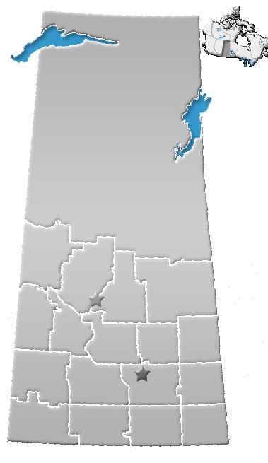
Map of Division No. 2, SK, Canada

City

  • Weyburn
  • Towns

  • Bengough
  • Midale
  • Milestone
  • Ogema
  • Radville
  • Yellow Grass
  • Rural Municipalities

  • RM No. 6 Cambria
  • RM No. 7 Souris Valley
  • RM No. 8 Lake Alma
  • RM No. 9 Surprise Valley
  • RM No. 10 Happy Valley
  • RM No. 36 Cymri
  • RM No. 37 Lomond
  • RM No. 38 Laurier
  • RM No. 39 The Gap
  • RM No. 40 Bengough
  • RM No. 66 Griffin
  • RM No. 67 Weyburn
  • RM No. 68 Brokenshell
  • RM No. 69 Norton
  • RM No. 70 Key West
  • RM No. 96 Fillmore
  • RM No. 97 Wellington
  • RM No. 98 Scott
  • RM No. 99 Caledonia
  • RM No. 100 Elmsthorpe
  • Indian reserves

  • Indian Reserve --Piapot Cree First Nation 75H
  • References

    Division No. 2, Saskatchewan Wikipedia