
Country Philippines Barangays Area 141.8 km² Province Zamboanga del Sur | Founded June 17, 1950 Time zone PST (UTC+8) Local time Wednesday 3:36 AM | |
 | ||
Region Zamboanga Peninsula (Region IX) District 2nd district of Zamboanga del Sur Weather 26°C, Wind NE at 13 km/h, 88% Humidity | ||
Dimataling is a fourth class municipality in the province of Zamboanga del Sur, Philippines. According to the 2015 census, it has a population of 30,081 people.
Contents
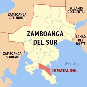
Map of Dimataling, Zamboanga del Sur, Philippines
Dimataling was created in 1950 from the barrios of Dinas, Legarda, Mirapao, Migpulao, Kalipapa, Pisaan, Bubway, Tiniguangan, Tabina and Dimataling from Pagadian City (not yet at city at that time) and the barrios of Punta Flecha, Pitogo, Qugbay, Balong-balong, Libertad and Dumanguilas from Margosatubig.
Barangays
Dimataling is administratively subdivided into 24 barangays.
References
Dimataling, Zamboanga del Sur Wikipedia(Text) CC BY-SA