
Elevation 823 m Parent range Mid-Atlantic Ridge | Prominence 823 m | |
 | ||
Similar Queen Mary's Peak, Inaccessible Island, Green Mountain, Nightingale Island | ||
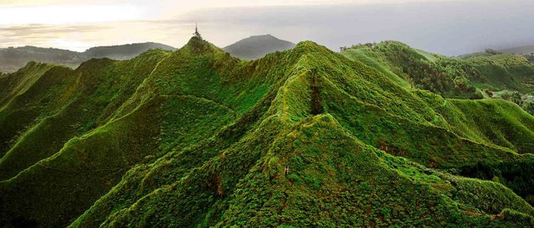
Diana's Peak is the highest point, at 818 metres (2,684 ft), on the island of Saint Helena, a British overseas territory in the South Atlantic Ocean. It is of volcanic origin. Mountain and its surroundings with a total area of 81 ha were proclaimed a national park in March 1996, the first on the island. It is covered in tree fern thicket.
Map of Diana's Peak, STHL 1ZZ, Saint Helena, Ascension and Tristan da Cunha
The peak is located at the tripoint where the districts Sandy Bay (southwest), Levelwood (east) and Longwood (north) meet. The closest settlements are Bamboo Hedge (the main settlement of Sandy Bay District), Hutt's Gate (in Longwood District) and Levelwood Village.
References
Diana's Peak Wikipedia(Text) CC BY-SA