
Elevation 1,435 m Mountain range Basin and Range Province | Prominence 153 m Parent range Basin and Range Province | |
 | ||
Age of rock 7320 to 7790 calendar years. B.P. Similar Jordan Craters, Blue Lake Crater, Cinnamon Butte, Indian Heaven, Bald Knoll | ||
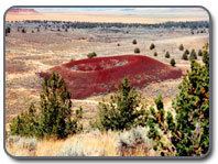
Diamond Craters is a monogenetic volcanic field in southeastern Oregon, about 40 miles (64 km) southeast of the city of Burns. It consists of a 27-square-mile (70 km2) area of basaltic lava flows, cinder cones, and maars. The reexamination of radiocarbon dates from older studies and interpretation of paleomagnetic data and new radiocarbon dates limits the eruption of volcanic vents in this volcanic field to the time period between 7320 and 7790 calendar years B.P.
Map of Diamond Craters, Oregon 97722, USA
Diamond Craters and the nearby Diamond post office were named after the Diamond Ranch, established in the area by the pioneer Mace McCoy. The ranch used a diamond-shaped brand, hence the name.
In the 1970s, Diamond Craters was a source of controversy between the Bureau of Land Management and commercial stonecutters who were illegally removing slabs of lava to sell as veneer for fireplaces, home exteriors, and chimneys. Geologists familiar with the area cited the craters' unusual research value, a "museum of basaltic volcanic features" apt to be destroyed by slab harvesting and associated heavy equipment. In 1982, the area gained additional protection when it was designated an Outstanding Natural Area.