
 | ||
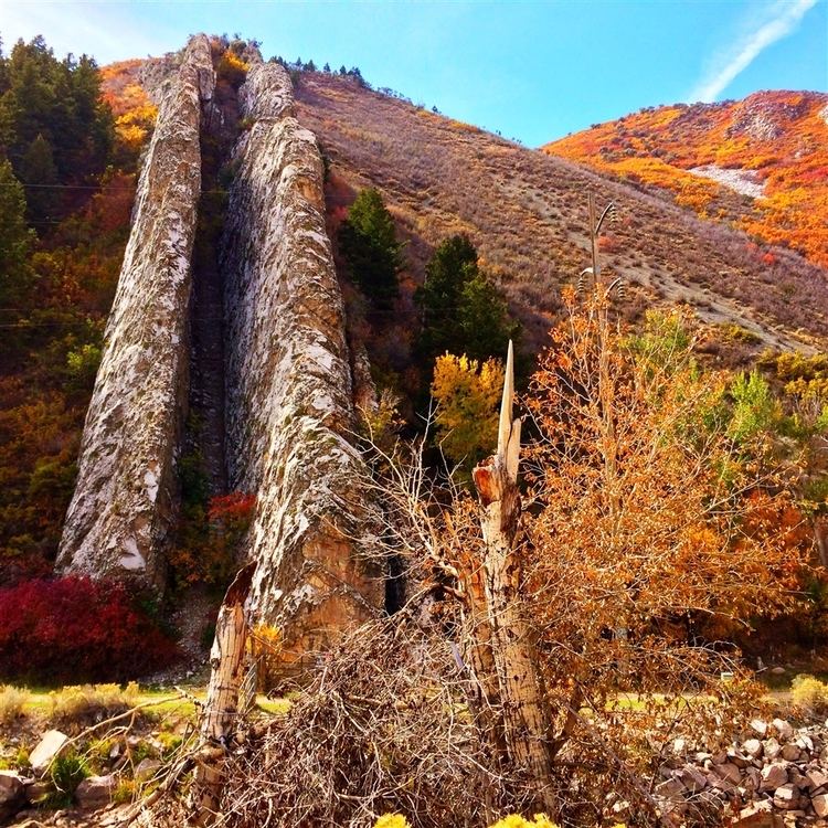
Devil's Slide is an unusual geological formation located near the border of Wyoming in northern Utah's Weber Canyon, near the community of Croydon in Morgan County, Utah, United States. The slide consists of two parallel limestone strata that have been tilted to lie vertical, protruding 40 feet (12 m) out of the mountainside. Intervening layers have eroded more quickly, forming a channel some 25 feet (7.6 m) wide running hundreds of feet down the mountain.
Map of Devils Slide, Utah 84050, USA
I-84 runs right past Devil's Slide, which can be clearly seen from the road. The Weber River flows between the formation and the freeway. There are parking areas on both sides of the highway for viewing the slide.
References
Devil's Slide (Utah) Wikipedia(Text) CC BY-SA